
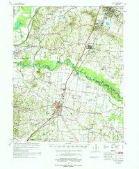
~ Rialto TN topo map, 1:62500 scale, 15 X 15 Minute, Historical, 1977, updated 1977
Rialto, Tennessee, USGS topographic map dated 1977.
Includes geographic coordinates (latitude and longitude). This topographic map is suitable for hiking, camping, and exploring, or framing it as a wall map.
Printed on-demand using high resolution imagery, on heavy weight and acid free paper, or alternatively on a variety of synthetic materials.
Topos available on paper, Waterproof, Poly, or Tyvek. Usually shipping rolled, unless combined with other folded maps in one order.
- Product Number: USGS-5338798
- Free digital map download (high-resolution, GeoPDF): Rialto, Tennessee (file size: 8 MB)
- Map Size: please refer to the dimensions of the GeoPDF map above
- Weight (paper map): ca. 55 grams
- Map Type: POD USGS Topographic Map
- Map Series: HTMC
- Map Verison: Historical
- Cell ID: 61582
- Scan ID: 155936
- Imprint Year: 1977
- Woodland Tint: Yes
- Aerial Photo Year: 1971
- Field Check Year: 1974
- Datum: NAD27
- Map Projection: Polyconic
- Map published by United States Army Corps of Engineers
- Map Language: English
- Scanner Resolution: 600 dpi
- Map Cell Name: Rialto
- Grid size: 15 X 15 Minute
- Date on map: 1977
- Map Scale: 1:62500
- Geographical region: Tennessee, United States
Neighboring Maps:
All neighboring USGS topo maps are available for sale online at a variety of scales.
Spatial coverage:
Topo map Rialto, Tennessee, covers the geographical area associated the following places:
- Asbury - Rialto - Luckett - Three Point - Leighs - Quail Creek - Henning - Cotton Lake - Opossum - Hurricane Hill - Lightfoot - Gift - Oak Hill Subdivision - Olive Branch - Mack - Avreet - Antioch - Covington - Solo - Pleasant Hill - Holly Grove - Tabernacle - Green Hills - Cherry - Bride - Ripley - Fort Pillow - Country Wood - Mount Lebanon - Glimp
- Map Area ID: AREA35.7535.5-89.75-89.5
- Northwest corner Lat/Long code: USGSNW35.75-89.75
- Northeast corner Lat/Long code: USGSNE35.75-89.5
- Southwest corner Lat/Long code: USGSSW35.5-89.75
- Southeast corner Lat/Long code: USGSSE35.5-89.5
- Northern map edge Latitude: 35.75
- Southern map edge Latitude: 35.5
- Western map edge Longitude: -89.75
- Eastern map edge Longitude: -89.5


