
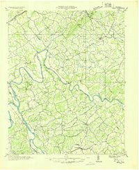
~ Small TN topo map, 1:48000 scale, 15 X 15 Minute, Historical, 1935
Small, Tennessee, USGS topographic map dated 1935.
Includes geographic coordinates (latitude and longitude). This topographic map is suitable for hiking, camping, and exploring, or framing it as a wall map.
Printed on-demand using high resolution imagery, on heavy weight and acid free paper, or alternatively on a variety of synthetic materials.
Topos available on paper, Waterproof, Poly, or Tyvek. Usually shipping rolled, unless combined with other folded maps in one order.
- Product Number: USGS-5338616
- Free digital map download (high-resolution, GeoPDF): Small, Tennessee (file size: 8 MB)
- Map Size: please refer to the dimensions of the GeoPDF map above
- Weight (paper map): ca. 55 grams
- Map Type: POD USGS Topographic Map
- Map Series: HTMC
- Map Verison: Historical
- Cell ID: 62694
- Scan ID: 153360
- Woodland Tint: Yes
- Field Check Year: 1935
- Datum: NAD27
- Map Projection: Polyconic
- Advance: Yes
- Planimetric: Yes
- Map published by Tennessee Valley Authority
- Map Language: English
- Scanner Resolution: 600 dpi
- Map Cell Name: Small
- Grid size: 15 X 15 Minute
- Date on map: 1935
- Map Scale: 1:48000
- Geographical region: Tennessee, United States
Neighboring Maps:
All neighboring USGS topo maps are available for sale online at a variety of scales.
Spatial coverage:
Topo map Small, Tennessee, covers the geographical area associated the following places:
- Bybee - Point Pleasant - Beulah - Fuller Estates - Lilac (historical) - Brookside Mill - Brockland Acres - Windvue Estates - Chuckey Bend (historical) - Holttown - Union Heights - Kingswood - Belair - Parrottsville - Hurley Acres - Nenny - Springvale - Mount Airy Springs - Warrensburg - Wolf Acres - Fowler Grove - Silver City - Rankin - High Point - Lampkin Acres - Sherwood Estates - Creek Store - Salem - Ottinger - Scoot Mill - Mohawk - Liberty Hill - Barton Springs - Briar Thicket - Mohawk Crossroad - East Village - Thula - Inman (historical) - Rocky Point - Bruner Grove - Leadvale - Glendale - Bird Hill - Pate Hill - Pineville - Skinner Crossroad - Redwine - Susong - Dover
- Map Area ID: AREA36.2536-83.25-83
- Northwest corner Lat/Long code: USGSNW36.25-83.25
- Northeast corner Lat/Long code: USGSNE36.25-83
- Southwest corner Lat/Long code: USGSSW36-83.25
- Southeast corner Lat/Long code: USGSSE36-83
- Northern map edge Latitude: 36.25
- Southern map edge Latitude: 36
- Western map edge Longitude: -83.25
- Eastern map edge Longitude: -83


