
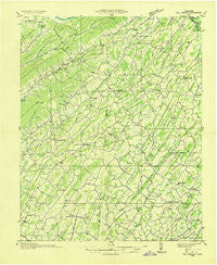
~ Fall Branch TN topo map, 1:48000 scale, 15 X 15 Minute, Historical, 1935
Fall Branch, Tennessee, USGS topographic map dated 1935.
Includes geographic coordinates (latitude and longitude). This topographic map is suitable for hiking, camping, and exploring, or framing it as a wall map.
Printed on-demand using high resolution imagery, on heavy weight and acid free paper, or alternatively on a variety of synthetic materials.
Topos available on paper, Waterproof, Poly, or Tyvek. Usually shipping rolled, unless combined with other folded maps in one order.
- Product Number: USGS-5338588
- Free digital map download (high-resolution, GeoPDF): Fall Branch, Tennessee (file size: 8 MB)
- Map Size: please refer to the dimensions of the GeoPDF map above
- Weight (paper map): ca. 55 grams
- Map Type: POD USGS Topographic Map
- Map Series: HTMC
- Map Verison: Historical
- Cell ID: 73534
- Scan ID: 147965
- Woodland Tint: Yes
- Field Check Year: 1935
- Datum: NAD27
- Map Projection: Polyconic
- Advance: Yes
- Planimetric: Yes
- Map published by Tennessee Valley Authority
- Map Language: English
- Scanner Resolution: 600 dpi
- Map Cell Name: Fall Branch
- Grid size: 15 X 15 Minute
- Date on map: 1935
- Map Scale: 1:48000
- Geographical region: Tennessee, United States
Neighboring Maps:
All neighboring USGS topo maps are available for sale online at a variety of scales.
Spatial coverage:
Topo map Fall Branch, Tennessee, covers the geographical area associated the following places:
- McPheeter Bend - Colonial Acres - Glen Alpine - Colonial Heights - Harbour - Centersville - Leesburg - Swanay (historical) - Fordtown - Matuta (historical) - Liberty Hill - Easley Estates - Ducktown - Oakland - Union Temple - Blue Ridge Estates - Luke (historical) - Dykes Mill - Maltsberger (historical) - Applewalk Park - Poplar Grove - Butterfly (historical) - Hartmantown - Summer Hills - Vernon Heights - Kincheloe Mill - Big Sandy - Sullivan Gardens - Sulphur Springs - Oak Hill - Grandview - Horse Creek - Glendale - Kendrick Creek (historical) - Mill Brook - Mitchell Springs - Slaughter (historical) - Pine Grove - Graysburg - Locust Mount - Taylor Mill - Milburnton - Fairview - Pleasant Valley - Cloverbottom (historical) - Cedar Lane - Lovelace - Jearoldstown - Goshen - Woodstone Estates - Double Springs - Gabtown - Harmony - Lone Star - Keys Mill - Rock Springs - Quail Creek - Mayflower (historical) - Deerfield - Summersville - Stewart Hill - Bald Crossing - Meadowbrook - Pleasant Vale - Haws Crossroads - Bowmantown - Ford Crossing - Historic Hills - Conkintown - Fall Branch - Wheelocktown (historical) - Christie (historical) - Blair Gap - Pactolus
- Map Area ID: AREA36.536.25-82.75-82.5
- Northwest corner Lat/Long code: USGSNW36.5-82.75
- Northeast corner Lat/Long code: USGSNE36.5-82.5
- Southwest corner Lat/Long code: USGSSW36.25-82.75
- Southeast corner Lat/Long code: USGSSE36.25-82.5
- Northern map edge Latitude: 36.5
- Southern map edge Latitude: 36.25
- Western map edge Longitude: -82.75
- Eastern map edge Longitude: -82.5


