
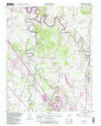
~ Walterhill TN topo map, 1:24000 scale, 7.5 X 7.5 Minute, Historical, 1998, updated 1999
Walterhill, Tennessee, USGS topographic map dated 1998.
Includes geographic coordinates (latitude and longitude). This topographic map is suitable for hiking, camping, and exploring, or framing it as a wall map.
Printed on-demand using high resolution imagery, on heavy weight and acid free paper, or alternatively on a variety of synthetic materials.
Topos available on paper, Waterproof, Poly, or Tyvek. Usually shipping rolled, unless combined with other folded maps in one order.
- Product Number: USGS-5338200
- Free digital map download (high-resolution, GeoPDF): Walterhill, Tennessee (file size: 11 MB)
- Map Size: please refer to the dimensions of the GeoPDF map above
- Weight (paper map): ca. 55 grams
- Map Type: POD USGS Topographic Map
- Map Series: HTMC
- Map Verison: Historical
- Cell ID: 47369
- Scan ID: 148756
- Imprint Year: 1999
- Woodland Tint: Yes
- Photo Inspection Year: 1998
- Aerial Photo Year: 1981
- Survey Year: 1949
- Datum: NAD27
- Map Projection: Lambert Conformal Conic
- Map published by United States Geological Survey
- Map Language: English
- Scanner Resolution: 600 dpi
- Map Cell Name: Walterhill
- Grid size: 7.5 X 7.5 Minute
- Date on map: 1998
- Map Scale: 1:24000
- Geographical region: Tennessee, United States
Neighboring Maps:
All neighboring USGS topo maps are available for sale online at a variety of scales.
Spatial coverage:
Topo map Walterhill, Tennessee, covers the geographical area associated the following places:
- Cherry Hill Estates - Timberlake - Blansett Meadows - Haynes Haven - Georgetown - Florence - Palmer Heights - Riverbend - Fairmont - Mona - Regency Park - Cooks Corner - Yorktown - Wade - Joneswood - Asbury Prk - Little Ranch Acres - Miller Estates - Northpointe Hall - Colonial Village - Rowland Estates - White Haven - Leanna - BAttlefield Meadows - Kings Estates - Walter Hill Estates - Pioneer Estates - Reynolds - Indian Springs - Henry Lane - Hooper Acres - Hales Camp - Mount Olive - Bethel - Williamsburg - Sawyer Subdivision - Jamestown - Walterhill - Hickory Grove - Confederate Glen Estates - Sunnyside - Key Estates - Halewood Hills - Nestledown Estates - Hillwood Estates - Lake Farm Estates - Young Subdivision - Blackman - Juniper Acres - Ridgefield - Joywood - Creekmont - Riverview - Cherry Lane Acres - Royal Court - Lamb - Ravenwood
- Map Area ID: AREA3635.875-86.5-86.375
- Northwest corner Lat/Long code: USGSNW36-86.5
- Northeast corner Lat/Long code: USGSNE36-86.375
- Southwest corner Lat/Long code: USGSSW35.875-86.5
- Southeast corner Lat/Long code: USGSSE35.875-86.375
- Northern map edge Latitude: 36
- Southern map edge Latitude: 35.875
- Western map edge Longitude: -86.5
- Eastern map edge Longitude: -86.375


