
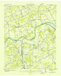
~ Kykers Ferry TN topo map, 1:24000 scale, 7.5 X 7.5 Minute, Historical, 1935
Kykers Ferry, Tennessee, USGS topographic map dated 1935.
Includes geographic coordinates (latitude and longitude). This topographic map is suitable for hiking, camping, and exploring, or framing it as a wall map.
Printed on-demand using high resolution imagery, on heavy weight and acid free paper, or alternatively on a variety of synthetic materials.
Topos available on paper, Waterproof, Poly, or Tyvek. Usually shipping rolled, unless combined with other folded maps in one order.
- Product Number: USGS-5335442
- Free digital map download (high-resolution, GeoPDF): Kykers Ferry, Tennessee (file size: 7 MB)
- Map Size: please refer to the dimensions of the GeoPDF map above
- Weight (paper map): ca. 55 grams
- Map Type: POD USGS Topographic Map
- Map Series: HTMC
- Map Verison: Historical
- Cell ID: 12661
- Scan ID: 147960
- Woodland Tint: Yes
- Field Check Year: 1935
- Datum: NAD27
- Map Projection: Polyconic
- Advance: Yes
- Planimetric: Yes
- Map published by Tennessee Valley Authority
- Map Language: English
- Scanner Resolution: 600 dpi
- Map Cell Name: Douglas Dam
- Grid size: 7.5 X 7.5 Minute
- Date on map: 1935
- Map Scale: 1:24000
- Geographical region: Tennessee, United States
Neighboring Maps:
All neighboring USGS topo maps are available for sale online at a variety of scales.
Spatial coverage:
Topo map Kykers Ferry, Tennessee, covers the geographical area associated the following places:
- Union Grove - Fairview Heights - Cate crossroad - Catlettsburg - Alder Branch - Millican Grove - Yettland Park - Union Hill - Ewing (historical) - Henry Crossroads - Dumplin Mill - Deep Springs - French Broad (historical) - Gibson Acres Mobile Home Park - Evergreen Pointe Mobile Home Park - Revilo (historical) - Beech Springs - Cook Mill - Powder Springs (historical)
- Map Area ID: AREA3635.875-83.625-83.5
- Northwest corner Lat/Long code: USGSNW36-83.625
- Northeast corner Lat/Long code: USGSNE36-83.5
- Southwest corner Lat/Long code: USGSSW35.875-83.625
- Southeast corner Lat/Long code: USGSSE35.875-83.5
- Northern map edge Latitude: 36
- Southern map edge Latitude: 35.875
- Western map edge Longitude: -83.625
- Eastern map edge Longitude: -83.5


