
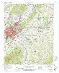
~ Johnson City TN topo map, 1:24000 scale, 7.5 X 7.5 Minute, Historical, 1959, updated 1991
Johnson City, Tennessee, USGS topographic map dated 1959.
Includes geographic coordinates (latitude and longitude). This topographic map is suitable for hiking, camping, and exploring, or framing it as a wall map.
Printed on-demand using high resolution imagery, on heavy weight and acid free paper, or alternatively on a variety of synthetic materials.
Topos available on paper, Waterproof, Poly, or Tyvek. Usually shipping rolled, unless combined with other folded maps in one order.
- Product Number: USGS-5335250
- Free digital map download (high-resolution, GeoPDF): Johnson City, Tennessee (file size: 16 MB)
- Map Size: please refer to the dimensions of the GeoPDF map above
- Weight (paper map): ca. 55 grams
- Map Type: POD USGS Topographic Map
- Map Series: HTMC
- Map Verison: Historical
- Cell ID: 22686
- Scan ID: 143994
- Imprint Year: 1991
- Woodland Tint: Yes
- Visual Version Number: 2
- Photo Revision Year: 1968
- Aerial Photo Year: 1968
- Datum: NAD27
- Map Projection: Polyconic
- Map published by Tennessee Valley Authority
- Map Language: English
- Scanner Resolution: 600 dpi
- Map Cell Name: Johnson City
- Grid size: 7.5 X 7.5 Minute
- Date on map: 1959
- Map Scale: 1:24000
- Geographical region: Tennessee, United States
Neighboring Maps:
All neighboring USGS topo maps are available for sale online at a variety of scales.
Spatial coverage:
Topo map Johnson City, Tennessee, covers the geographical area associated the following places:
- Camp Wildwood - Pine Ridge - Austin Village - East Park - Wayfield - Bel Air One - Sinking Creek - Woodstone - South Gate Village - Princeton Hills - Stoney Brook - Green Pine - Meadowview - Okolona Estates - Okolona - Gomp Addition - Monterey Hills - Glen Ridge - Bel Air Two - Johnson City - Oak Park - Hillrise - Grandview - Sunset - Powder Branch - Martindale Estates - Gilmer Park - Reston Court - Piney Grove - Pine Hills - Mountain Home - Wildwood - Barnes - Riovista - Melrose - Holly Hill - Milligan - Dogwood Acres - Oakland Gardens - Hidden Oaks - Idlewilde - Montcastle Hills - Vanover Park - Cedar Grove - College Park - Oakland Village - Reece Terrace - Tanglewood - S E Miller Subdivision - N C Love Addition - Range - Buffalo View - Heritage Park - Plymouth Park - Oak Grove - Big Valley Mobile Home Park - Watauga Point - Cherokee Hills - Keystone - Princeton - Brookmead - Georgia Terrace - Tunbridge - Fairlawn - Garland Acres - Central - Hickory Lake - Hiwassee Heights - Meadowbrook Mobile Home Park - Breezy Hills - Rural Ridge - Southwest Addition - Carnegie - Watauga - Roan Hill - Buckstone Hills - Rolling Hills - Pine Crest - East Ridge - Strawberry Fields - Shenandoah Heights - Hillmont Heights
- Map Area ID: AREA36.37536.25-82.375-82.25
- Northwest corner Lat/Long code: USGSNW36.375-82.375
- Northeast corner Lat/Long code: USGSNE36.375-82.25
- Southwest corner Lat/Long code: USGSSW36.25-82.375
- Southeast corner Lat/Long code: USGSSE36.25-82.25
- Northern map edge Latitude: 36.375
- Southern map edge Latitude: 36.25
- Western map edge Longitude: -82.375
- Eastern map edge Longitude: -82.25


