
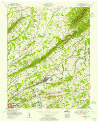
~ John Sevier TN topo map, 1:24000 scale, 7.5 X 7.5 Minute, Historical, 1953, updated 1955
John Sevier, Tennessee, USGS topographic map dated 1953.
Includes geographic coordinates (latitude and longitude). This topographic map is suitable for hiking, camping, and exploring, or framing it as a wall map.
Printed on-demand using high resolution imagery, on heavy weight and acid free paper, or alternatively on a variety of synthetic materials.
Topos available on paper, Waterproof, Poly, or Tyvek. Usually shipping rolled, unless combined with other folded maps in one order.
- Product Number: USGS-5335244
- Free digital map download (high-resolution, GeoPDF): John Sevier, Tennessee (file size: 13 MB)
- Map Size: please refer to the dimensions of the GeoPDF map above
- Weight (paper map): ca. 55 grams
- Map Type: POD USGS Topographic Map
- Map Series: HTMC
- Map Verison: Historical
- Cell ID: 22665
- Scan ID: 147858
- Imprint Year: 1955
- Woodland Tint: Yes
- Aerial Photo Year: 1939
- Field Check Year: 1953
- Datum: NAD27
- Map Projection: Polyconic
- Map published by Tennessee Valley Authority
- Map Language: English
- Scanner Resolution: 600 dpi
- Map Cell Name: John Sevier
- Grid size: 7.5 X 7.5 Minute
- Date on map: 1953
- Map Scale: 1:24000
- Geographical region: Tennessee, United States
Neighboring Maps:
All neighboring USGS topo maps are available for sale online at a variety of scales.
Spatial coverage:
Topo map John Sevier, Tennessee, covers the geographical area associated the following places:
- Brookfield Acres - Loveland - Kings Valley - Carpenter Addition - Three Points - Sunrise - Millertown - Wooddale - Caswell - Mayo (historical) - Skaggston - Antioch - Holston Mobile Home Park - Maloneyville - Sentertown - McMillan - Happy Acres - Chilhowee Hills - Shipetown - Eastwood - Ritta - Arminda - Harbison Crossroads - Ridgeview Heights - Spring Place - John Sevier - Plantation Acres Mobile Home Park - Highpoint (historical)
- Map Area ID: AREA36.12536-83.875-83.75
- Northwest corner Lat/Long code: USGSNW36.125-83.875
- Northeast corner Lat/Long code: USGSNE36.125-83.75
- Southwest corner Lat/Long code: USGSSW36-83.875
- Southeast corner Lat/Long code: USGSSE36-83.75
- Northern map edge Latitude: 36.125
- Southern map edge Latitude: 36
- Western map edge Longitude: -83.875
- Eastern map edge Longitude: -83.75


