
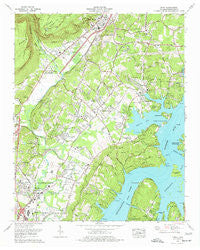
~ Daisy TN topo map, 1:24000 scale, 7.5 X 7.5 Minute, Historical, 1976, updated 1977
Daisy, Tennessee, USGS topographic map dated 1976.
Includes geographic coordinates (latitude and longitude). This topographic map is suitable for hiking, camping, and exploring, or framing it as a wall map.
Printed on-demand using high resolution imagery, on heavy weight and acid free paper, or alternatively on a variety of synthetic materials.
Topos available on paper, Waterproof, Poly, or Tyvek. Usually shipping rolled, unless combined with other folded maps in one order.
- Product Number: USGS-5333756
- Free digital map download (high-resolution, GeoPDF): Daisy, Tennessee (file size: 14 MB)
- Map Size: please refer to the dimensions of the GeoPDF map above
- Weight (paper map): ca. 55 grams
- Map Type: POD USGS Topographic Map
- Map Series: HTMC
- Map Verison: Historical
- Cell ID: 11200
- Scan ID: 149672
- Imprint Year: 1977
- Woodland Tint: Yes
- Aerial Photo Year: 1974
- Edit Year: 1975
- Field Check Year: 1976
- Datum: NAD27
- Map Projection: Polyconic
- Map published by Tennessee Valley Authority
- Map Language: English
- Scanner Resolution: 600 dpi
- Map Cell Name: Daisy
- Grid size: 7.5 X 7.5 Minute
- Date on map: 1976
- Map Scale: 1:24000
- Geographical region: Tennessee, United States
Neighboring Maps:
All neighboring USGS topo maps are available for sale online at a variety of scales.
Spatial coverage:
Topo map Daisy, Tennessee, covers the geographical area associated the following places:
- Timberwick - Fairview - Prairie Creek - Pinetree Estates - Towne Hills - Northshore Hills - Dallas Gardens - Northern Hills - Kings Ridge - Ridge Lake North - Waconda Point - Tall Pines Mobile Home Park - Harrison Bluff - Riverchase - Hampton Woods - Greens Mill - Jeffery Acres - Lake Harbor Estates - Melville - Dallas Hills - Northmont Estates - Hidden Hills Estates - Huntingdon Forest - Foxwood Estates - Shelton Estates - Hixson - Bartlebaugh Subdivision - Briarfield - Mimosa Trailer Park - Dallas (historical) - Daisy - Dallas Branch - Parkshore Estates - Clearwater Acres - Valleybrook - Middle Valley - Cross Timbers - Blue Ridge View - Lakesite - Lower Mill - Gold Point Estates - Caramel Village - Forest Meade - Hillcrest Estates - Sandalwood Village - Forestwood - Crabtree Hills - Richland Crest - Middle Valley Estates - Prairie Peninsula - New Salem - Sterling Park - Crestfield - Dent Acres - Ardis Mobile Home Park - Town Hills - Mile Straight - Fanetta Gardens - Soddy-Daisy - Farrington Forest - Green Hills - Country Oaks Estates - Stoneridge - Shannon Hills - Olde Mill - Colonial Shores - Ridge Bay - Lake Dweller - Ivanwood Acres - Port Serena - Dana Hills - Dallas Hollow - Sequoyah Hills - Lakeside Park - Green Cove - Hidden Harbor - Garden Farms - Hickory Woods - Long Branch - Springcrest - Echo Glen - Irongate
- Map Area ID: AREA35.2535.125-85.25-85.125
- Northwest corner Lat/Long code: USGSNW35.25-85.25
- Northeast corner Lat/Long code: USGSNE35.25-85.125
- Southwest corner Lat/Long code: USGSSW35.125-85.25
- Southeast corner Lat/Long code: USGSSE35.125-85.125
- Northern map edge Latitude: 35.25
- Southern map edge Latitude: 35.125
- Western map edge Longitude: -85.25
- Eastern map edge Longitude: -85.125


