
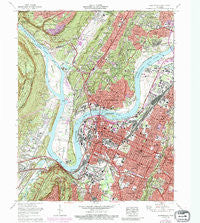
~ Chattanooga TN topo map, 1:24000 scale, 7.5 X 7.5 Minute, Historical, 1969, updated 1987
Chattanooga, Tennessee, USGS topographic map dated 1969.
Includes geographic coordinates (latitude and longitude). This topographic map is suitable for hiking, camping, and exploring, or framing it as a wall map.
Printed on-demand using high resolution imagery, on heavy weight and acid free paper, or alternatively on a variety of synthetic materials.
Topos available on paper, Waterproof, Poly, or Tyvek. Usually shipping rolled, unless combined with other folded maps in one order.
- Product Number: USGS-5333338
- Free digital map download (high-resolution, GeoPDF): Chattanooga, Tennessee (file size: 19 MB)
- Map Size: please refer to the dimensions of the GeoPDF map above
- Weight (paper map): ca. 55 grams
- Map Type: POD USGS Topographic Map
- Map Series: HTMC
- Map Verison: Historical
- Cell ID: 8285
- Scan ID: 148901
- Imprint Year: 1987
- Woodland Tint: Yes
- Photo Revision Year: 1976
- Aerial Photo Year: 1976
- Edit Year: 1968
- Field Check Year: 1969
- Datum: NAD27
- Map Projection: Polyconic
- Map published by Tennessee Valley Authority
- Map Language: English
- Scanner Resolution: 600 dpi
- Map Cell Name: Chattanooga
- Grid size: 7.5 X 7.5 Minute
- Date on map: 1969
- Map Scale: 1:24000
- Geographical region: Tennessee, United States
Neighboring Maps:
All neighboring USGS topo maps are available for sale online at a variety of scales.
Spatial coverage:
Topo map Chattanooga, Tennessee, covers the geographical area associated the following places:
- Clarks Mobile Home Park - Red Bank - Rivermont - Highland Park - Woodland Heights - Blaney Forest - Signal Mountain - East Lake - Clifton Hills - Knollwood - East Ridge - Stuart Heights - Poindexter Heights - Oakhurst - Riverside Park - Armstrong Trailer Park - Claremont - Manchester Park - Spring Valley - Tiftonia - Orchard Knob - Old Farm - Forest Highlands - Ridgedale - Avondale - Fairfax Heights - Ruby Falls - Bushtown - Signal Hills - Jones Mobile Home Park - Quail Hollow - Foust - Boyce - Alton Park - Fort Cheatham - Valley Village - Mountain Ridge - Lupton City - Pan Gap - Fairhills - Ridgeside - Balmoral - Carriage Hill - Glendale - Dallas Crest - Tuckegee (historical) - Colonial Village - Fountain Village - Midvale - Easton Terrace - Pineville - Hampton Heights - Duncan Hills - Chattanooga - Lockwood Heights - North Chattanooga - Andrea Heights - Lake Village - Valdeau - White Oak - Palisades - Oak Grove - Dallas Heights - River Hills - Elder Mountain - Riverview - Glenwood
- Map Area ID: AREA35.12535-85.375-85.25
- Northwest corner Lat/Long code: USGSNW35.125-85.375
- Northeast corner Lat/Long code: USGSNE35.125-85.25
- Southwest corner Lat/Long code: USGSSW35-85.375
- Southeast corner Lat/Long code: USGSSE35-85.25
- Northern map edge Latitude: 35.125
- Southern map edge Latitude: 35
- Western map edge Longitude: -85.375
- Eastern map edge Longitude: -85.25


