
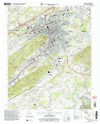
~ Bristol TN topo map, 1:24000 scale, 7.5 X 7.5 Minute, Historical, 2003, updated 2004
Bristol, Tennessee, USGS topographic map dated 2003.
Includes geographic coordinates (latitude and longitude). This topographic map is suitable for hiking, camping, and exploring, or framing it as a wall map.
Printed on-demand using high resolution imagery, on heavy weight and acid free paper, or alternatively on a variety of synthetic materials.
Topos available on paper, Waterproof, Poly, or Tyvek. Usually shipping rolled, unless combined with other folded maps in one order.
- Product Number: USGS-5332898
- Free digital map download (high-resolution, GeoPDF): Bristol, Tennessee (file size: 16 MB)
- Map Size: please refer to the dimensions of the GeoPDF map above
- Weight (paper map): ca. 55 grams
- Map Type: POD USGS Topographic Map
- Map Series: HTMC
- Map Verison: Historical
- Cell ID: 5504
- Scan ID: 143787
- Imprint Year: 2004
- Woodland Tint: Yes
- Aerial Photo Year: 1997
- Edit Year: 2003
- Datum: NAD27
- Map Projection: Lambert Conformal Conic
- Map published by United States Forest Service
- Map Language: English
- Scanner Resolution: 600 dpi
- Map Cell Name: Bristol
- Grid size: 7.5 X 7.5 Minute
- Date on map: 2003
- Map Scale: 1:24000
- Geographical region: Tennessee, United States
Neighboring Maps:
All neighboring USGS topo maps are available for sale online at a variety of scales.
Spatial coverage:
Topo map Bristol, Tennessee, covers the geographical area associated the following places:
- Grandview Terrace - Haynesfield - Springdale - Driftwood - Candlewyck - Marlyn Hills - Valley Hills - Forest Hills - Ridgedale - Barytes - Oak Hill - Bristol - Belle Brook Estates - Tennessee Hills - Beidlemans (historical) - Briardale - Fairmount - Sugarville - Redstone - West Ridge - Vance - Holston View - Malcolm - McChesney Heights - Kingtown - Evergreen - Collingwood - Blue Ridge - Holston Hills - Hunter Hills - Horizon Hills - Paperville - Brookmead - Larkin Hills - Springdale - Ridgefield - Spring Garden - Ruthton - Briarwood - Gray Acres - Johnson Court - Westfield - Edgemont - Weaver - Avoca - Edgefield - Three Springs - Cedar Valley - Deerfield Acres - Shakesville - Sunnybrook Number Two - Virginia Hills - Springfield Acres - Meadow Crest - Virginia Heights - Crest View - Fair Acres - Belle Meadows - Sunny Brook - Graystone Estates - Larwood - Rock Hill Park - Bristol
- Map Area ID: AREA36.62536.5-82.25-82.125
- Northwest corner Lat/Long code: USGSNW36.625-82.25
- Northeast corner Lat/Long code: USGSNE36.625-82.125
- Southwest corner Lat/Long code: USGSSW36.5-82.25
- Southeast corner Lat/Long code: USGSSE36.5-82.125
- Northern map edge Latitude: 36.625
- Southern map edge Latitude: 36.5
- Western map edge Longitude: -82.25
- Eastern map edge Longitude: -82.125


