
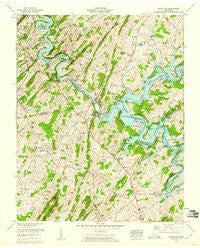
~ Boone Dam TN topo map, 1:24000 scale, 7.5 X 7.5 Minute, Historical, 1959, updated 1960
Boone Dam, Tennessee, USGS topographic map dated 1959.
Includes geographic coordinates (latitude and longitude). This topographic map is suitable for hiking, camping, and exploring, or framing it as a wall map.
Printed on-demand using high resolution imagery, on heavy weight and acid free paper, or alternatively on a variety of synthetic materials.
Topos available on paper, Waterproof, Poly, or Tyvek. Usually shipping rolled, unless combined with other folded maps in one order.
- Product Number: USGS-5332828
- Free digital map download (high-resolution, GeoPDF): Boone Dam, Tennessee (file size: 14 MB)
- Map Size: please refer to the dimensions of the GeoPDF map above
- Weight (paper map): ca. 55 grams
- Map Type: POD USGS Topographic Map
- Map Series: HTMC
- Map Verison: Historical
- Cell ID: 4848
- Scan ID: 149454
- Imprint Year: 1960
- Woodland Tint: Yes
- Aerial Photo Year: 1958
- Field Check Year: 1959
- Datum: NAD27
- Map Projection: Polyconic
- Map published by Tennessee Valley Authority
- Map Language: English
- Scanner Resolution: 600 dpi
- Map Cell Name: Boone Dam
- Grid size: 7.5 X 7.5 Minute
- Date on map: 1959
- Map Scale: 1:24000
- Geographical region: Tennessee, United States
Neighboring Maps:
All neighboring USGS topo maps are available for sale online at a variety of scales.
Spatial coverage:
Topo map Boone Dam, Tennessee, covers the geographical area associated the following places:
- Buffalo Ridge (historical) - Colby (historical) - Gray - Oak Grove - Samuel (historical) - Kitzmiller (historical) - Flourville - Crouch Crossroad - Wahoo (historical) - Boring - Englewood - Oak Grove Village Mobile Home Park - Lake Crest - Hilton (historical) - Spurgeon - El Rancho - Fourville - Boone - Baker Bluff Subdivision - Royal Pines - Boones Creek - Holston - Smith Shoals Subdivision
- Map Area ID: AREA36.536.375-82.5-82.375
- Northwest corner Lat/Long code: USGSNW36.5-82.5
- Northeast corner Lat/Long code: USGSNE36.5-82.375
- Southwest corner Lat/Long code: USGSSW36.375-82.5
- Southeast corner Lat/Long code: USGSSE36.375-82.375
- Northern map edge Latitude: 36.5
- Southern map edge Latitude: 36.375
- Western map edge Longitude: -82.5
- Eastern map edge Longitude: -82.375


