
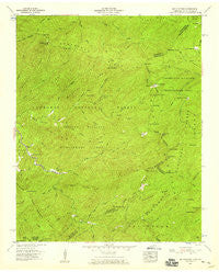
~ Big Junction TN topo map, 1:24000 scale, 7.5 X 7.5 Minute, Historical, 1957, updated 1959
Big Junction, Tennessee, USGS topographic map dated 1957.
Includes geographic coordinates (latitude and longitude). This topographic map is suitable for hiking, camping, and exploring, or framing it as a wall map.
Printed on-demand using high resolution imagery, on heavy weight and acid free paper, or alternatively on a variety of synthetic materials.
Topos available on paper, Waterproof, Poly, or Tyvek. Usually shipping rolled, unless combined with other folded maps in one order.
- Product Number: USGS-5332674
- Free digital map download (high-resolution, GeoPDF): Big Junction, Tennessee (file size: 14 MB)
- Map Size: please refer to the dimensions of the GeoPDF map above
- Weight (paper map): ca. 55 grams
- Map Type: POD USGS Topographic Map
- Map Series: HTMC
- Map Verison: Historical
- Cell ID: 3751
- Scan ID: 149466
- Imprint Year: 1959
- Woodland Tint: Yes
- Aerial Photo Year: 1953
- Field Check Year: 1957
- Datum: NAD27
- Map Projection: Polyconic
- Map published by Tennessee Valley Authority
- Map Language: English
- Scanner Resolution: 600 dpi
- Map Cell Name: Big Junction
- Grid size: 7.5 X 7.5 Minute
- Date on map: 1957
- Map Scale: 1:24000
- Geographical region: Tennessee, United States
Neighboring Maps:
All neighboring USGS topo maps are available for sale online at a variety of scales.
Spatial coverage:
Topo map Big Junction, Tennessee, covers the geographical area associated the following places:
- Bob Bald - Sassafras Ridge - State Ridge - South Fork Citico Trail - Brushy Ridge Observation Site - Sugar Mountain Trail - Roaring Branch - Big Indian Branch Trail - Johns Branch - Davis Creek Recreation Area - Brush Mountain - Davis Creek - Big Junction - Sycamore Creek - Deep Gap - Rattlesnake Rock - Bob Creek - Peckerwood Ridge - Mangan Branch - Service Tree Branch - County Corners - Fain Cabin - Whigg Branch - Bob Branch - Hawk Knob - Big Oak Cove Recreation Area - Hogjaw Gap - Spivey Creek - Jeffrey Trail - Falls Branch - Round Mountain Branch - Indian Branch - Birch Branch - Eagle Gap - Pheasant Field Fishing Site - Fain Ford - Holder Cove Branch - Grassy Branch - Peckerwood Creek - Sugar Mountain - Haw Knob - Laurel Branch - Pantherflat Top - State Line Recreation Area - Gold Cove Branch - Sugar Cove Trail - Mud Gap - Kirkland Cove - Hampton Lead - Grassy Gap - Stratton Meadows - Hemlock Knob - Bearpen Branch - Jenks Branch - Stratton Gap - Tipton Creek - Grassy Gap - Strawberry Knob - Meadow Branch - Queen Cove - Pleasant Field Rearing Pools - Pleasant Branch - Little Haw Knob - Johns Knob - Mistletoe Creek - Rough Ridge Creek - Big Oak Cove Creek - Pine Ridge - Fall Branch Scenic Area - Sugar Mountain Lead - Pheasant Field Rearing Pools - Dillard Top - Whigg Meadow - Green Cove Branch - Lookingglass Mountain - Green Cove Cemetery - Stratton Meadows - Little Bald - Rowe Lake Dam - Rough Ridge - McNabb Creek Trail - Red Log Gap - Sugar Cove Branch - Tellico River Lodge - McIntyre Lead - Brushy Ridge - Whigg Cabin - Round Mountain - Hemlock Trail - Mitchell Lick - Rowe Lake - Round Mountain Branch - Laurel Top - Lake View Observation Site - Spivey Cove Recreation Area - Big Cove Branch - Laurel Branch Trail - Whigg Ridge Trail - Swan Meadows - Grassy Top
- Map Area ID: AREA35.37535.25-84.125-84
- Northwest corner Lat/Long code: USGSNW35.375-84.125
- Northeast corner Lat/Long code: USGSNE35.375-84
- Southwest corner Lat/Long code: USGSSW35.25-84.125
- Southeast corner Lat/Long code: USGSSE35.25-84
- Northern map edge Latitude: 35.375
- Southern map edge Latitude: 35.25
- Western map edge Longitude: -84.125
- Eastern map edge Longitude: -84


