
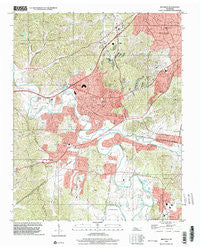
~ Bellevue TN topo map, 1:24000 scale, 7.5 X 7.5 Minute, Historical, 1997, updated 2002
Bellevue, Tennessee, USGS topographic map dated 1997.
Includes geographic coordinates (latitude and longitude). This topographic map is suitable for hiking, camping, and exploring, or framing it as a wall map.
Printed on-demand using high resolution imagery, on heavy weight and acid free paper, or alternatively on a variety of synthetic materials.
Topos available on paper, Waterproof, Poly, or Tyvek. Usually shipping rolled, unless combined with other folded maps in one order.
- Product Number: USGS-5332602
- Free digital map download (high-resolution, GeoPDF): Bellevue, Tennessee (file size: 15 MB)
- Map Size: please refer to the dimensions of the GeoPDF map above
- Weight (paper map): ca. 55 grams
- Map Type: POD USGS Topographic Map
- Map Series: HTMC
- Map Verison: Historical
- Cell ID: 3198
- Scan ID: 143736
- Imprint Year: 2002
- Woodland Tint: Yes
- Aerial Photo Year: 1997
- Datum: NAD83
- Map Projection: Universal Transverse Mercator
- Map published by United States Geological Survey
- Map Language: English
- Scanner Resolution: 600 dpi
- Map Cell Name: Bellevue
- Grid size: 7.5 X 7.5 Minute
- Date on map: 1997
- Map Scale: 1:24000
- Geographical region: Tennessee, United States
Neighboring Maps:
All neighboring USGS topo maps are available for sale online at a variety of scales.
Spatial coverage:
Topo map Bellevue, Tennessee, covers the geographical area associated the following places:
- Pickens Acres - Vaughns Gap - Bethlehem - Dunkled Estates - Bellevue - Steeple Chase Farms - Seventeen Seventysix Estates - Bethany Hills - West Meade - Harpeth River Estates - Poplar Hills - Trace End Estates - Sunnyside Estates - Sneed Glen - Temple Hills Country Club Estates - Hunters Ridge - Natchez Hills Estate - Walnut Hills - Grassland Estates - Iroquois Meadows - Longwood - Hillsboro Valley - Hunters Hill - Pasquo - Red Bud - Sneed Forest Estates - River Rest - Newsom - Harpeth Estates - Tennessee Towne (historical) - Devonshire Manor
- Map Area ID: AREA36.12536-87-86.875
- Northwest corner Lat/Long code: USGSNW36.125-87
- Northeast corner Lat/Long code: USGSNE36.125-86.875
- Southwest corner Lat/Long code: USGSSW36-87
- Southeast corner Lat/Long code: USGSSE36-86.875
- Northern map edge Latitude: 36.125
- Southern map edge Latitude: 36
- Western map edge Longitude: -87
- Eastern map edge Longitude: -86.875


