
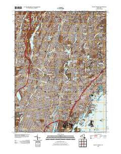
~ Mount Vernon NY topo map, 1:24000 scale, 7.5 X 7.5 Minute, Historical, 2010
Mount Vernon, New York, USGS topographic map dated 2010.
Includes geographic coordinates (latitude and longitude). This topographic map is suitable for hiking, camping, and exploring, or framing it as a wall map.
Printed on-demand using high resolution imagery, on heavy weight and acid free paper, or alternatively on a variety of synthetic materials.
Topos available on paper, Waterproof, Poly, or Tyvek. Usually shipping rolled, unless combined with other folded maps in one order.
- Product Number: USGS-5237122
- Free digital map download (high-resolution, GeoPDF): Mount Vernon, New York (file size: 27 MB)
- Map Size: please refer to the dimensions of the GeoPDF map above
- Weight (paper map): ca. 55 grams
- Map Type: POD USGS Topographic Map
- Map Series: US Topo
- Map Verison: Historical
- Cell ID: 70998
- Datum: North American Datum of 1983
- Map Projection: Transverse Mercator
- Map Cell Name: Mount Vernon
- Grid size: 7.5 X 7.5 Minute
- Date on map: 2010
- Map Scale: 1:24000
- Geographical region: New York, United States
Neighboring Maps:
All neighboring USGS topo maps are available for sale online at a variety of scales.
Spatial coverage:
Topo map Mount Vernon, New York, covers the geographical area associated the following places:
- Gun Hill Houses - Vernon Park - Bronxville Heights - Bayberry Park - North Pelham - Maplewood - Cotswold - Sun Haven - Chester Hill Park - Wakefield - Grey Oaks - Rochelle Heights - West Mount Vernon - New Rochelle - Dunwoodie Heights - Beechmont - Beverly Crest - Lawrence Park - Forest Heights - Bonnie Crest - Empire Park - Williams Bridge - Pinebrook - Elmsmere - Colonial Acres - Murray Hill - Greenville - Heath Ridge - White Birches - Colonial Heights - Fleetwood - Isle of San Souci - Greens At Cherry Lawn - Dunwoodie - Arthur Manor - Mount Hope - Victory Park - Murdock Woods - Sunny Brae - Cedar Knolls - Halcyon Park - Wilmot Woods - Waverly - Scarsdale Downs - Baychester Houses - Heathcote - Pinebrook Heights - Nepera Park - Beechmont Woods - Wykagyl Park - Chester Heights - Rochelle Park - Pinckney Heights - Larchmont - Woodlawn - Parkside - Pelham Manor - Wykagyl - Woodside - Homestead Park - Pelham - Mohegan Heights - Secor Gardens - Edenwald Houses - Cecil Park - Bryn Mawr Park - Residence Park - Gunther Park - Nepperhan - Bronxville - Eastchester - Crestwood - Moorelands - Eastchester Heights - Beech Hill - Tuckahoe - Scarsdale Park - Nepperhan Heights - Eastchester - Gramatan Hills - Quaker Ridge - Forest Knolls - Huguenot Park - McLean Heights - Lincoln Heights - Rosedale - Mount Vernon - Pine Brook - Crestwood Gardens
- Map Area ID: AREA4140.875-73.875-73.75
- Northwest corner Lat/Long code: USGSNW41-73.875
- Northeast corner Lat/Long code: USGSNE41-73.75
- Southwest corner Lat/Long code: USGSSW40.875-73.875
- Southeast corner Lat/Long code: USGSSE40.875-73.75
- Northern map edge Latitude: 41
- Southern map edge Latitude: 40.875
- Western map edge Longitude: -73.875
- Eastern map edge Longitude: -73.75


