
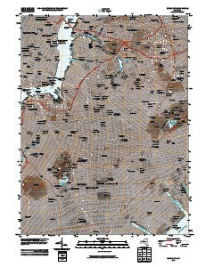
~ Brooklyn NY topo map, 1:24000 scale, 7.5 X 7.5 Minute, Historical, 2010
Brooklyn, New York, USGS topographic map dated 2010.
Includes geographic coordinates (latitude and longitude). This topographic map is suitable for hiking, camping, and exploring, or framing it as a wall map.
Printed on-demand using high resolution imagery, on heavy weight and acid free paper, or alternatively on a variety of synthetic materials.
Topos available on paper, Waterproof, Poly, or Tyvek. Usually shipping rolled, unless combined with other folded maps in one order.
- Product Number: USGS-5150852
- Free digital map download (high-resolution, GeoPDF): Brooklyn, New York (file size: 20 MB)
- Map Size: please refer to the dimensions of the GeoPDF map above
- Weight (paper map): ca. 55 grams
- Map Type: POD USGS Topographic Map
- Map Series: US Topo
- Map Verison: Historical
- Cell ID: 5628
- Datum: North American Datum of 1983
- Map Projection: Transverse Mercator
- Map Cell Name: Brooklyn
- Grid size: 7.5 X 7.5 Minute
- Date on map: 2010
- Map Scale: 1:24000
- Geographical region: New York, United States
Neighboring Maps:
All neighboring USGS topo maps are available for sale online at a variety of scales.
Spatial coverage:
Topo map Brooklyn, New York, covers the geographical area associated the following places:
- Flatbush - Ridgewood - Henry Street Settlement - Fresh Pond Junction - Gashouse District - Amalgamated Dwellings - South Brooklyn - Adelphi - Park Slope - East Village - Columbusville (historical) - East Flatbush - Eleanor Roosevelt Houses - Bedford-Stuyvesant - Williamsburg Houses - Glendale - Bushwick Junction - Long Island City - Vinegar Hill - Fresh Pond - Hester - Allen Turnkey Housing - Old Germania Heights - Tompkins Houses - Greenpoint - Cobble Hill - Woodside - Peter Cooper Village - Rose Hill - Haberman - Brooklyn Heights - Penn Station South - Soho - Medgar Evers Houses - Governor Alfred E Smith Houses - Sunnyside - Brevoort Houses - Linden Hill - Murray Hill - East River Houses - Blissville - Ebbets Field Houses - Chinatown - East New York - Elmhurst - Marcy Houses - Williamsburg - Tudor City - Marcus Garvey Village - Flatiron District - Lower East Side - Rhinelander Gardens (historical) - Brownsville - Rutland Plaza - Middle Village - Sunnyside Gardens - Jacob Riis Houses - Jonathan Williams Houses - Borough Park - Stuyvesant Town - Broadway Junction - Kips Bay - Fort Greene - Maspeth - Parkville - Bushwick Houses - Washington Square Village - Little Italy - Clinton Hill - Wyckoff Gardens - Cypress Hills - Brooklyn - Lafayette Houses - Eastern Parkway - Atlantic Terminal Houses - City Line - Grammercy Park - Kensington - Gowanus Houses - Bay View Houses - Breukelen Houses - Hillman Housing - Loisaida - Warren Street Houses - University Village - Paerdegat - Knickerbocker Village - Spring Creek Towers - Paerdegat - Bushwick - Sumner Houses - Canarsie
- Map Area ID: AREA40.7540.625-74-73.875
- Northwest corner Lat/Long code: USGSNW40.75-74
- Northeast corner Lat/Long code: USGSNE40.75-73.875
- Southwest corner Lat/Long code: USGSSW40.625-74
- Southeast corner Lat/Long code: USGSSE40.625-73.875
- Northern map edge Latitude: 40.75
- Southern map edge Latitude: 40.625
- Western map edge Longitude: -74
- Eastern map edge Longitude: -73.875


