
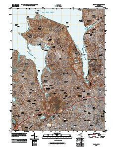
~ Sea Cliff NY topo map, 1:24000 scale, 7.5 X 7.5 Minute, Historical, 2010
Sea Cliff, New York, USGS topographic map dated 2010.
Includes geographic coordinates (latitude and longitude). This topographic map is suitable for hiking, camping, and exploring, or framing it as a wall map.
Printed on-demand using high resolution imagery, on heavy weight and acid free paper, or alternatively on a variety of synthetic materials.
Topos available on paper, Waterproof, Poly, or Tyvek. Usually shipping rolled, unless combined with other folded maps in one order.
- Product Number: USGS-5141483
- Free digital map download (high-resolution, GeoPDF): Sea Cliff, New York (file size: 29 MB)
- Map Size: please refer to the dimensions of the GeoPDF map above
- Weight (paper map): ca. 55 grams
- Map Type: POD USGS Topographic Map
- Map Series: US Topo
- Map Verison: Historical
- Cell ID: 71545
- Datum: North American Datum of 1983
- Map Projection: Transverse Mercator
- Map Cell Name: Sea Cliff
- Grid size: 7.5 X 7.5 Minute
- Date on map: 2010
- Map Scale: 1:24000
- Geographical region: New York, United States
Neighboring Maps:
All neighboring USGS topo maps are available for sale online at a variety of scales.
Spatial coverage:
Topo map Sea Cliff, New York, covers the geographical area associated the following places:
- Saddle Rock Estates - Kensington - Manorhaven - Saddle Rock - East Hills - Kings Point - University Gardens - Plandome Heights - Great Neck Gardens - Glen Cove Landing - Baxter Estates - Manhasset Hills - Herricks - Glenwood Landing - Roslyn - Plandome - Hillside Manor - Albertson - Thomaston - Great Neck Plaza - Russell Gardens - Flower Hill - Williston Park - Sea Cliff - Strathmore - Port Washington North - Greenvale - South Glenwood Landing - Lake Success - Plandome Manor - Sands Point - Roslyn Estates - Glen Cove - Roslyn Heights - East Williston - Manhasset - Roslyn Harbor - Harbor Hills - North Hills - Great Neck Estates - Searingtown - East Atlantic Beach - Munsey Park - Port Washington - Great Neck - Douglaston - Little Neck
- Map Area ID: AREA40.87540.75-73.75-73.625
- Northwest corner Lat/Long code: USGSNW40.875-73.75
- Northeast corner Lat/Long code: USGSNE40.875-73.625
- Southwest corner Lat/Long code: USGSSW40.75-73.75
- Southeast corner Lat/Long code: USGSSE40.75-73.625
- Northern map edge Latitude: 40.875
- Southern map edge Latitude: 40.75
- Western map edge Longitude: -73.75
- Eastern map edge Longitude: -73.625


