
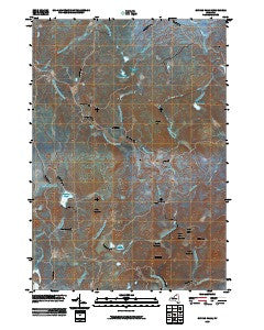
~ Sylvan Falls NY topo map, 1:24000 scale, 7.5 X 7.5 Minute, Historical, 2010
Sylvan Falls, New York, USGS topographic map dated 2010.
Includes geographic coordinates (latitude and longitude). This topographic map is suitable for hiking, camping, and exploring, or framing it as a wall map.
Printed on-demand using high resolution imagery, on heavy weight and acid free paper, or alternatively on a variety of synthetic materials.
Topos available on paper, Waterproof, Poly, or Tyvek. Usually shipping rolled, unless combined with other folded maps in one order.
- Product Number: USGS-5133211
- Free digital map download (high-resolution, GeoPDF): Sylvan Falls, New York (file size: 18 MB)
- Map Size: please refer to the dimensions of the GeoPDF map above
- Weight (paper map): ca. 55 grams
- Map Type: POD USGS Topographic Map
- Map Series: US Topo
- Map Verison: Historical
- Cell ID: 44081
- Datum: North American Datum of 1983
- Map Projection: Transverse Mercator
- Map Cell Name: Sylvan Falls
- Grid size: 7.5 X 7.5 Minute
- Date on map: 2010
- Map Scale: 1:24000
- Geographical region: New York, United States
Neighboring Maps:
All neighboring USGS topo maps are available for sale online at a variety of scales.
Spatial coverage:
Topo map Sylvan Falls, New York, covers the geographical area associated the following places:
- The Bog Outlet - Hopkinton Pond - Sylvan Falls - Stony Brook - Randle Meadow Brook - Sugar Grove Mountain - School Number 13 (historical) - Saint Lawrence State Forest Number 8 - Dead Creek - Welch Brook - The Bog - Coulon Cemetery - Mud Pond - Sterling Pond - Hamilton Mountain - Loon Mountain - Wick School (historical) - Flower Hill - Sterling Pond Outlet - Coffee Mountain - Slough Pond - Fenner Meadow Brook - Kingsley Falls - Randle Meadows - Mud Pond Outlet - Fenner Meadows - Bear Mountain - Town of Hopkinton - Thomas Brook - Hogback Brook - Santimaw Brook - Balsam Brook - Cooperage Club - Sugar Grove Pass - Randle Meadow Brook - Twin Ponds - Bruner Falls - Willis Brook - Harper School (historical)
- Map Area ID: AREA44.62544.5-74.75-74.625
- Northwest corner Lat/Long code: USGSNW44.625-74.75
- Northeast corner Lat/Long code: USGSNE44.625-74.625
- Southwest corner Lat/Long code: USGSSW44.5-74.75
- Southeast corner Lat/Long code: USGSSE44.5-74.625
- Northern map edge Latitude: 44.625
- Southern map edge Latitude: 44.5
- Western map edge Longitude: -74.75
- Eastern map edge Longitude: -74.625


