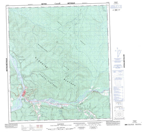
116B03 Dawson Canada topo map, 1:50,000 scale
116B03 Dawson NRCAN topographic map.
Includes UTM and GPS geographic coordinates (latitude and longitude). This 50k scale map is suitable for hiking, camping, and exploring, or you could frame it as a wall map.
Printed on-demand using high resolution, on heavy weight and acid free paper, or as an upgrade on a variety of synthetic materials.
Topos available on paper, Waterproof, Poly, or Tyvek. Usually shipping rolled, unless combined with other folded maps in one order.
- Product Number: NRCAN-116B03
- Parent Topo: TOPO-116B
- Map ID also known as: 116B03, 116B3
- Unfolded Size: Approximately 26" high by 36" wide
- Weight (paper map): ca. 55 grams
- Map Type: POD NRCAN Topographic Map
- Map Scale: 1:50,000
- Geographical region: Yukon, Canada
Neighboring Maps:
All neighboring Canadian topo maps are available for sale online at 1:50,000 scale.
Purchase the smaller scale map covering this area: Topo-116B
Spatial coverage:
Topo map sheet 116B03 Dawson covers the following places:
- Moosehide Creek 2 - Dog Island - Sister Island - Australian Hill - Cripple Hill - Dago Hill - Grouse Mountain - Klondike Hills - Lovett Hill - Midnight Dome - Moosehide Hills - Moosehide Mountain - North Klondike Range - Ogilvie Mountains - Ogilvie Range - Preido Hill - Dawson Historical Complex National Historic Site of Canada - Former Territorial Court House National Historic Site of Canada - Lieu historique national du Canada de l'Ancien-Palais-de-Justice-Territorial - Lieu historique national du Canada du Complexe-Historique-de-Dawson - Lieu historique national du Canada S.S. Keno - S.S. Keno National Historic Site of Canada - Klondike Plateau - Yukon Plateau - 4 Above Pup - 77 Pup - 8 Below Pup - Alki Creek - Ballarat Creek - Bear Creek - Benson Creek - Bonanza Creek - Bradley Creek - Clear Creek - Coal Creek - Dawson Creek - Deadwood Creek - Dion Creek - Discovery Pup - Eight Pup - Eighty Pup - Fleuve Yukon - Fourth Creek - Fysh Creek - Hulme Creek - Hunker Creek - Jeckell Creek - Klondike River - Last Chance Creek - Last Chance Creek - Lee Creek - Lepine Creek - Lewes River - Moosehide Creek - No Name Creek - Noble Creek - North Rock Creek - Pepin Creek - Rock Creek - Ruiter Creek - Seventy Seven Pup - Shovel Creek - Small Creek - Sol Pup - Watt Creek - Yukon River - Dawson - Arlington - Bear Creek - Fort Reliance - Klondike - Last Chance - Moosehide - Rock Creek - West Dawson - 20 Pup - 21 Pup - Belcher Gulch - Bergamin Gulch - Bordeleau Gulch - California Gulch - Cripple Gulch - Dago Gulch - Examiner Gulch - Falconer Gulch - Fireman Gulch - Foster Gulch - Guysboro Gulch - Hattie Gulch - Henry Gulch - Jackson Gulch - Lovett Gulch - Quigley Gulch - Rabbit Gulch - Sawmill Gulch - Thirteen Gulch - Thomas Gulch - Tinhorn Gulch - Tintina Trench - Tintina Valley - Trail Gulch - Wet Gulch - Wood Gulch


