
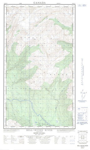
104A06E Bell Irving River Canada topo map, 1:50,000 scale
104A06E Bell Irving River NRCAN topographic map.
Includes UTM and GPS geographic coordinates (latitude and longitude). This 50k scale map is suitable for hiking, camping, and exploring, or you could frame it as a wall map.
Printed on-demand using high resolution, on heavy weight and acid free paper, or as an upgrade on a variety of synthetic materials.
Topos available on paper, Waterproof, Poly, or Tyvek. Usually shipping rolled, unless combined with other folded maps in one order.
- Halfsheet: This map was designed as a half sheet of NRCAN-104A06, and it is the Eastern half. Find the western half sheet here.
- Product Number: NRCAN-104A06E
- Parent Topo: TOPO-104A
- Map ID also known as: 104A06, 104A6
- Unfolded Size: Approximately 26" high by 36" wide
- Weight (paper map): ca. 55 grams
- Map Type: POD NRCAN Topographic Map
- Map Scale: 1:50,000
- Geographical region: British Columbia, Canada
Neighboring Maps:
All neighboring Canadian topo maps are available for sale online at 1:50,000 scale.
Purchase the smaller scale map covering this area: Topo-104A
Spatial coverage:
Topo map sheet 104A06E Bell Irving River covers the following places:
- Hickman Bay - Nesbitt Bay - Bowser Lake - Dog Lake - Hidden Lake - Boundary Ranges - Coast Mountains - Hanna Ridge - Longview Range - Mount Bell-Irving - Mount Ritchie - Strata Range - Wildfire Ridge - Regional District of Kitimat-Stikine - Bell-Irving River - Bowser River - Cleft Creek - Cousins Creek - Hanna Creek - Hanna River - Irving Creek - McInnes Creek - Ritchie Creek - Strata Creek - Surveyors Creek - Taft Creek - Tintina Creek - West Taylor River


