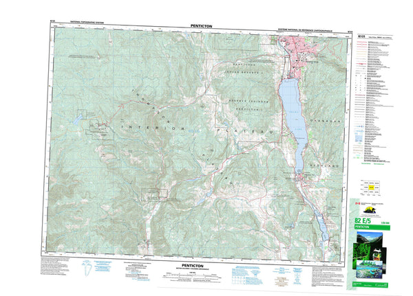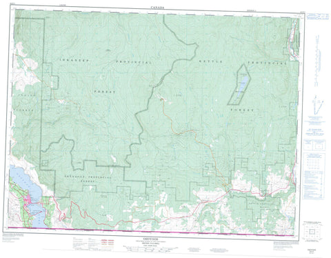
082E03 Osoyoos Canada topo map, 1:50,000 scale
082E03 Osoyoos NRCAN topographic map.
Includes UTM and GPS geographic coordinates (latitude and longitude). This 50k scale map is suitable for hiking, camping, and exploring, or you could frame it as a wall map.
Printed on-demand using high resolution, on heavy weight and acid free paper, or as an upgrade on a variety of synthetic materials.
Topos available on paper, Waterproof, Poly, or Tyvek. Usually shipping rolled, unless combined with other folded maps in one order.
- Product Number: NRCAN-082E03
- Parent Topo: TOPO-082E
- Map ID also known as: 082E03, 82E3, 82E03
- Unfolded Size: Approximately 26" high by 36" wide
- Weight (paper map): ca. 55 grams
- Map Type: POD NRCAN Topographic Map
- Map Scale: 1:50,000
- Geographical region: British Columbia, Canada
Neighboring Maps:
All neighboring Canadian topo maps are available for sale online at 1:50,000 scale.
Purchase the smaller scale map covering this area: Topo-082E
Spatial coverage:
Topo map sheet 082E03 Osoyoos covers the following places:
- Lacey Point - Osoyoos Indian Reserve 1 - Osoyoos Indian Reserve 3 - Réserve indienne Osoyoos 1 - Réserve indienne Osoyoos 3 - Conkle Lake - Ed James Lake - Little Fish Lake - Myers Lake - Osoyoos Lake - Peanut Lake - Anarchist Mountain - Baldy Mountain - Beaverdell Range - Mount Underdown - Okanagan Highland - Storm Hill - Regional District of Central Kootenay - Regional District of Kootenay-Boundary - Conkle Lake Park - Haynes Point Park - Johnstone Creek Park - Interior Plateau - Thompson Plateau - Atsiklak Creek - Baker Creek - Baldy Creek - Bourguiba Creek - Brides Creek - Budy Creek - Conkle Creek - Coteay Creek - East Creek - Ed James Creek - Gregoire Creek - Haynes Creek - Hulme Creek - Inkaneep Creek - Johnstone Creek - Jolly Creek - Kamloops Creek - Kettle River - Long Joe Creek - McCoy Creek - McCuddy Creek - McIntyre Creek - McKinney Creek - Mica Creek - Myers Creek - Nathan Creek - Nine Mile Creek - Rancher Creek - Rice Creek - Ripperto Creek - Rock Creek - Rusch Creek - Stanhope Creek - Strawberry Creek - Underdown Creek - Vaseux Creek - Wapiti Creek - West Kettle River - Westkettle River - Wildhorse Creek - Wolfcub Creek - Osoyoos - Bridesville - Camp McKinney - East Osoyoos - Mount Baldy - Myncaster - Rhone - Rock Creek - Sidley