
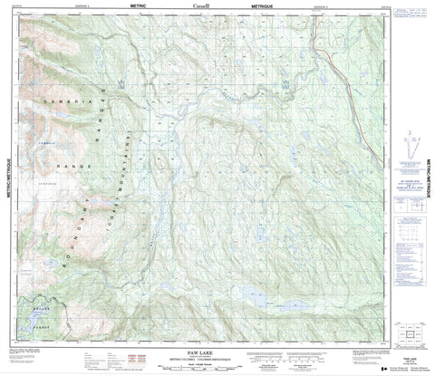
103P14 Paw Lake Canada topo map, 1:50,000 scale
103P14 Paw Lake NRCAN topographic map.
Includes UTM and GPS geographic coordinates (latitude and longitude). This 50k scale map is suitable for hiking, camping, and exploring, or you could frame it as a wall map.
Printed on-demand using high resolution, on heavy weight and acid free paper, or as an upgrade on a variety of synthetic materials.
Topos available on paper, Waterproof, Poly, or Tyvek. Usually shipping rolled, unless combined with other folded maps in one order.
- Product Number: NRCAN-103P14
- Parent Topo: TOPO-103P
- Map ID also known as: 103P14
- Unfolded Size: Approximately 26" high by 36" wide
- Weight (paper map): ca. 55 grams
- Map Type: POD NRCAN Topographic Map
- Map Scale: 1:50,000
- Geographical region: British Columbia, Canada
Neighboring Maps:
All neighboring Canadian topo maps are available for sale online at 1:50,000 scale.
Purchase the smaller scale map covering this area: Topo-103P
Spatial coverage:
Topo map sheet 103P14 Paw Lake covers the following places:
- Cambria Icefield - Femur Lake - Kitsault Lake - Lower Jade Lake - Niska Lakes - Paw Lake - Scrub Lake - Boundary Ranges - Cambrai Range - Cambria Range - Chaîne Côtière - Coast Mountains - Regional District of Kitimat-Stikine - Del Norte Creek - Femur Creek - Fish Creek - Flat River - Gleason Creek - Jade Creek - Kitanweliks Creek - Little Paw Creek - Moore Creek - Nass River - Nelson Creek - Niska Creek - Paw Creek - White River - Willoughby Creek - Wolverine Creek


