
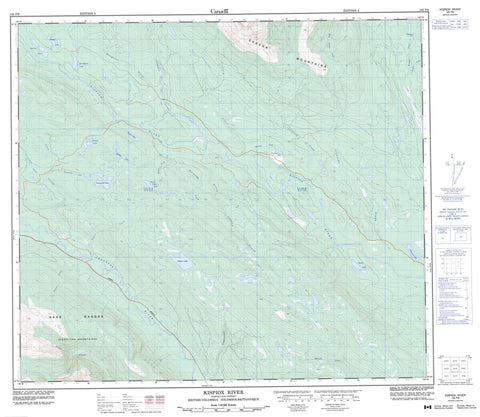
103P09 Kispiox River Canada topo map, 1:50,000 scale
103P09 Kispiox River NRCAN topographic map.
Includes UTM and GPS geographic coordinates (latitude and longitude). This 50k scale map is suitable for hiking, camping, and exploring, or you could frame it as a wall map.
Printed on-demand using high resolution, on heavy weight and acid free paper, or as an upgrade on a variety of synthetic materials.
Topos available on paper, Waterproof, Poly, or Tyvek. Usually shipping rolled, unless combined with other folded maps in one order.
- Product Number: NRCAN-103P09
- Parent Topo: TOPO-103P
- Map ID also known as: 103P09, 103P9
- Unfolded Size: Approximately 26" high by 36" wide
- Weight (paper map): ca. 55 grams
- Map Type: POD NRCAN Topographic Map
- Map Scale: 1:50,000
- Geographical region: British Columbia, Canada
Neighboring Maps:
All neighboring Canadian topo maps are available for sale online at 1:50,000 scale.
Purchase the smaller scale map covering this area: Topo-103P
Spatial coverage:
Topo map sheet 103P09 Kispiox River covers the following places:
- Brown Paint Lake - Deadhorse Lake - Douse Lake - Elizabeth Lake - Flatfish Lake - Footsore Lake - Greasetrail Lake - Hilltop Lake - Hodder Lake - Mitten Lake - Octopus Lake - Skunsnat Lake - Swordgrass Lake - Hazelton Mountains - Nass Ranges - Skeena Mountains - Regional District of Bulkley-Nechako - Regional District of Kitimat-Stikine - Aluk Creek - Beaverlodge Creek - Brown Paint Creek - Clifford Creek - Corral Creek - Cranberry River - Cullon Creek - Deep Canoe Creek - Douse Creek - Greasetrail Creek - Ironside Creek - Kispiox River - Kuitan Creek - McCully Creek - Mooluck Creek - Nangeese River - Skunsnat Creek - Steep Canyon Creek - Sweetin River - Thieves Creek - Tsugwinselda Creek - Weber Creek - Weegett Creek


