
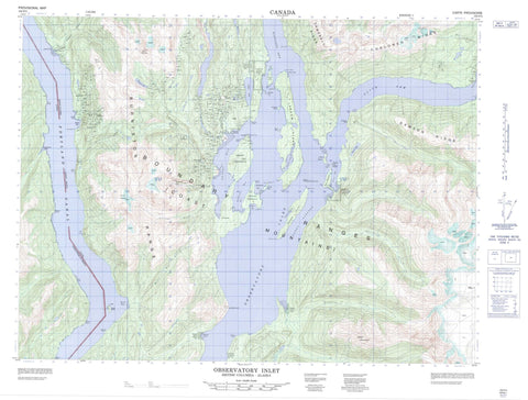
103P05 Observatory Inlet Canada topo map, 1:50,000 scale
103P05 Observatory Inlet NRCAN topographic map.
Includes UTM and GPS geographic coordinates (latitude and longitude). This 50k scale map is suitable for hiking, camping, and exploring, or you could frame it as a wall map.
Printed on-demand using high resolution, on heavy weight and acid free paper, or as an upgrade on a variety of synthetic materials.
Topos available on paper, Waterproof, Poly, or Tyvek. Usually shipping rolled, unless combined with other folded maps in one order.
- Product Number: NRCAN-103P05
- Parent Topo: TOPO-103P
- Map ID also known as: 103P05, 103P5
- Unfolded Size: Approximately 26" high by 36" wide
- Weight (paper map): ca. 55 grams
- Map Type: POD NRCAN Topographic Map
- Map Scale: 1:50,000
- Geographical region: British Columbia, Canada
Neighboring Maps:
All neighboring Canadian topo maps are available for sale online at 1:50,000 scale.
Purchase the smaller scale map covering this area: Topo-103P
Spatial coverage:
Topo map sheet 103P05 Observatory Inlet covers the following places:
- Alice Arm - Belle Bay - Granby Bay - Hastings Arm - Juggins Bay - Maple Bay - Mumford Cove - Observatory Inlet - Perry Bay - Salmon Cove - Strombeck Bay - Sylvester Bay - Aiskew Point - Azimuth Point - Bluff Point - Bocking Peninsula - Bonanza Point - Brooke Point - Car Point - Carr Point - Columbia Point - Davies Point - Dawkins Point - Fortier Point - Frank Point - Granby Peninsula - Granby Point - Graves Point - Hans Point - Johnson Point - Larcom Point - Maple Point - Pearson Point - Perry Peninsula - Perry Spit - Richards Point - Swamp Point - Thomas Point - Williams Point - Davies Passage - Liddle Channel - Paddy Passage - Portland Canal - Smith Bluff - Kinmelit Indian Reserve 20 - Ktsinet Indian Reserve 23 - Réserve indienne Kinmelit 20 - Réserve indienne Ktsinet 23 - Réserve indienne Slooks 21 - Réserve indienne Staqoo 22 - Réserve indienne Tackuan 26 - Réserve indienne Tackuan 26A - Slooks Indian Reserve 21 - Staqoo Indian Reserve 22 - Tackuan Indian Reserve 26 - Tackuan Indian Reserve 26A - Aiskew Island - Brooke Island - Carlson Islets - Doben Island - Guard Island - Guard Islet - Hattie Island - Larcom Island - Liddle Island - McGrath Island - Sophy Island - Stark Islet - Vadso Island - Bessie Lake - Bonanza Lake - Carney Lake - Ikzatk Lake - Ikzatqu Lake - Larcom Lagoon - Alice Mountain - Alice Peak - Boundary Ranges - Burniston Range - Campbell Range - Campbell Ridge - Chaîne Côtière - Chaloner Range - Chaloner Ridge - Coast Mountains - Dawson Range - Dawson Ridge - Hans Hill - Mount Clashmore - Mount Huntingdon - Mount Newport - Mount Tournay - Regional District of Kitimat-Stikine - Anyox Creek - Belle Bay Creek - Bluebell Creek - Bonanza Creek - Cascade Creek - Donahue Creek - Falls Creek - Glacier Creek - Gwunya Creek - Helen Creek - Hidden Creek - Isaac Creek - Kelskiist Creek - Nass River - Rodgers Creek - Showings Creek - Stagoo Creek - Stagoo River - Tauw Creek - Alice Rock - Anyox Rock - Brooke Shoal - Cane Rock - Davies Rock - Eik Rock - Forward Shoals - Hyde Rock - Vadso Rock - Vadso Rocks - Gwinmilit - Ksi Xts' at'kw - T'ak'uwaan - Xlukwskw - Xts'init - Anyox


