
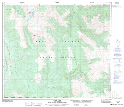
103P02 Lava Lake Canada topo map, 1:50,000 scale
103P02 Lava Lake NRCAN topographic map.
Includes UTM and GPS geographic coordinates (latitude and longitude). This 50k scale map is suitable for hiking, camping, and exploring, or you could frame it as a wall map.
Printed on-demand using high resolution, on heavy weight and acid free paper, or as an upgrade on a variety of synthetic materials.
Topos available on paper, Waterproof, Poly, or Tyvek. Usually shipping rolled, unless combined with other folded maps in one order.
- Product Number: NRCAN-103P02
- Parent Topo: TOPO-103P
- Map ID also known as: 103P02, 103P2
- Unfolded Size: Approximately 26" high by 36" wide
- Weight (paper map): ca. 55 grams
- Map Type: POD NRCAN Topographic Map
- Map Scale: 1:50,000
- Geographical region: British Columbia, Canada
Neighboring Maps:
All neighboring Canadian topo maps are available for sale online at 1:50,000 scale.
Purchase the smaller scale map covering this area: Topo-103P
Spatial coverage:
Topo map sheet 103P02 Lava Lake covers the following places:
- Jacks Lake - Lava Lake - Melita Lake - Ross Lake - Boundary Ranges - Coast Mountains - Hazelton Mountains - Kitimat Ranges - Mount Hoeft - Mount Philippa - Mount Priestley - Nass Range - Nass Ranges - Tseax Cone - Regional District of Kitimat-Stikine - Anhluut'ukwsim Laxmihl Angwinga'asanskwhl Nisga'a Park - Nisga'a Memorial Lava Bed Park - Nisga'a Memorial Lava Bed Recreation Area - Aquila Creek - Auk Creek - Bubo Creek - Canard Creek - Cedar River - Crater Creek - Eider Creek - Fulmar Creek - Gingit Creek - Gitzyon Creek - Insect Creek - Jacks Creek - Jay Creek - Kiteen River - Mosquito Creek - Seaskinnish Creek - Stenstrom Creek - Sterling Creek - Teal Creek - Tseax River - Tumbling Creek


