
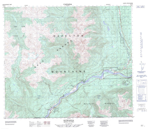
103P01 Kitwanga Canada topo map, 1:50,000 scale
103P01 Kitwanga NRCAN topographic map.
Includes UTM and GPS geographic coordinates (latitude and longitude). This 50k scale map is suitable for hiking, camping, and exploring, or you could frame it as a wall map.
Printed on-demand using high resolution, on heavy weight and acid free paper, or as an upgrade on a variety of synthetic materials.
Topos available on paper, Waterproof, Poly, or Tyvek. Usually shipping rolled, unless combined with other folded maps in one order.
- Product Number: NRCAN-103P01
- Parent Topo: TOPO-103P
- Map ID also known as: 103P01, 103P1
- Unfolded Size: Approximately 26" high by 36" wide
- Weight (paper map): ca. 55 grams
- Map Type: POD NRCAN Topographic Map
- Map Scale: 1:50,000
- Geographical region: British Columbia, Canada
Neighboring Maps:
All neighboring Canadian topo maps are available for sale online at 1:50,000 scale.
Purchase the smaller scale map covering this area: Topo-103P
Spatial coverage:
Topo map sheet 103P01 Kitwanga covers the following places:
- Gitanyow Indian Reserve 2 - Gitwangak Indian Reserve 1 - Gitwangak Indian Reserve 2 - Hazelton Indian Reserve 1 - Kits-ka-haws Indian Reserve 6 - Kitwancool Indian Reserve 2 - Kitwanga Indian Reserve 2 - Kitwangar Indian Reserve 1 - Koonwats Indian Reserve 7 - Réserve indienne Gitanyow 2 - Réserve indienne Gitwangak 1 - Réserve indienne Gitwangak 2 - Réserve indienne Hazelton 1 - Réserve indienne Kits-ka-haws 6 - Réserve indienne Kitwancool 2 - Réserve indienne Kitwanga 2 - Réserve indienne Kitwangar 1 - Réserve indienne Koonwats 7 - Réserve indienne Tum-bah 5 - Tum-bah Indian Reserve 5 - Shandilla Lakes - Bulkley Ranges - Hazelton Mountains - Nass Range - Nass Ranges - Regional District of Kitimat-Stikine - Gitwangak Battle Hill National Historic Site of Canada - Kitwanga Fort National Historic Site of Canada - Kitwanga Mountain Park - Lieu historique national du Canada de la Colline-Battle Hill-des-Gitwangaks - Lieu historique national du Canada du Fort-Kitwanga - Ace Creek - Casnorra Creek - Darling Creek - Deuce Creek - East Shandilla Creek - Gull Creek - Insect Creek - Kitwancool Creek - Kitwanga River - Mill Creek - Mosquito Creek - Sedan Creek - Shandilla Creek - Skeena River - Stenstrom Creek - Stronach Creek - West Sedan Creek - Wilson Creek - Cedarvale - Kitwanga - Woodcock - Cottonwood Canyon


