
103K03E Langara Canada topo map, 1:50,000 scale
103K03E Langara NRCAN topographic map.
Includes UTM and GPS geographic coordinates (latitude and longitude). This 50k scale map is suitable for hiking, camping, and exploring, or you could frame it as a wall map.
Printed on-demand using high resolution, on heavy weight and acid free paper, or as an upgrade on a variety of synthetic materials.
Topos available on paper, Waterproof, Poly, or Tyvek. Usually shipping rolled, unless combined with other folded maps in one order.
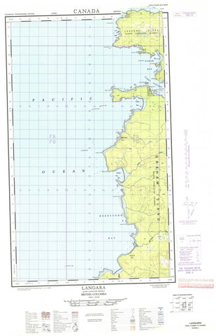
- Halfsheet: This map was designed as a half sheet of NRCAN-103K03, and it is the Eastern half. Find the western half sheet here.
- Product Number: NRCAN-103K03E
- Parent Topo: TOPO-103K
- Map ID also known as: 103K03, 103K3
- Unfolded Size: Approximately 26" high by 36" wide
- Weight (paper map): ca. 55 grams
- Map Type: POD NRCAN Topographic Map
- Map Scale: 1:50,000
- Geographical region: British Columbia, Canada
Neighboring Maps:
All neighboring Canadian topo maps are available for sale online at 1:50,000 scale.
Purchase the smaller scale map covering this area: Topo-103K
Spatial coverage:
Topo map sheet 103K03E Langara covers the following places:
- Beresford Bay - Cloak Bay - Fury Bay - Hazardous Cove - Henslung Cove - Lepas Bay - Lord Bight - Sialun Bay - Cape Knox - Caswell Point - Fleurieu Point - Hart Point - Iphigenia Point - Langara Point - Lauder Point - Meares Point - Rhodes Point - Sadler Point - St. Margaret Point - White Point - Boat Passage - Kusgwai Passage - Parry Passage - Guoyskun Indian Reserve 22 - Kioosta Indian Reserve 15 - Réserve indienne Guoyskun 22 - Réserve indienne Kioosta 15 - Réserve indienne Yasitkun 21 - Yasitkun Indian Reserve 21 - Cox Island - Graham Island - Lacy Island - Langara Island - Queen Charlotte Islands - Thrumb Islet - Newcombe Hill - Pivot Mountain - Pyramid Hill - Beresford Creek - Hana Koot Creek - Sialun Creek - Astrolabe Rock - Carew Rock - Chanal Reef - Gatenby Rock - Harvey Rock - La Pérouse Reef - Langara Rocks - Marchand Reef - Ocean Shoal - Sunday Reef - Swanton Bank - Turner Reef - Kiusta - Yaku


