
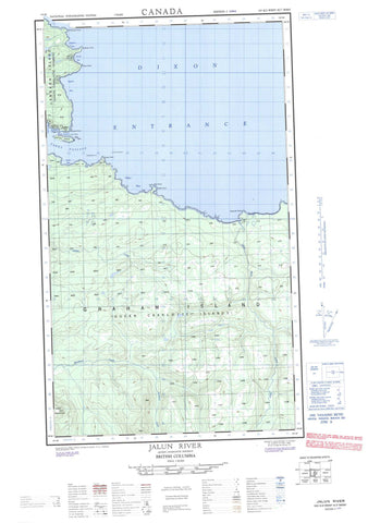
103K02W Jalun River Canada topo map, 1:50,000 scale
103K02W Jalun River NRCAN topographic map.
Includes UTM and GPS geographic coordinates (latitude and longitude). This 50k scale map is suitable for hiking, camping, and exploring, or you could frame it as a wall map.
Printed on-demand using high resolution, on heavy weight and acid free paper, or as an upgrade on a variety of synthetic materials.
Topos available on paper, Waterproof, Poly, or Tyvek. Usually shipping rolled, unless combined with other folded maps in one order.
- Halfsheet: This map was designed as a half sheet of NRCAN-103K02, and it is the Western half. Find the eastern half sheet here.
- Product Number: NRCAN-103K02W
- Parent Topo: TOPO-103K
- Map ID also known as: 103K02, 103K2
- Unfolded Size: Approximately 26" high by 36" wide
- Weight (paper map): ca. 55 grams
- Map Type: POD NRCAN Topographic Map
- Map Scale: 1:50,000
- Geographical region: British Columbia, Canada
Neighboring Maps:
All neighboring Canadian topo maps are available for sale online at 1:50,000 scale.
Purchase the smaller scale map covering this area: Topo-103K
Spatial coverage:
Topo map sheet 103K02W Jalun River covers the following places:
- Beal Cove - Bruin Bay - Craft Bay - Dibrell Bay - Egeria Bay - Explorer Bay - Hanna Bay - Henslung Cove - Hussan Bay - Naden Harbour - Pillar Bay - The Bar - Andrews Point - Bain Point - Cape Naden - Cohoe Point - Deep Water Point - Deepwater Point - George Point - Gunia Point - Holland Point - Inskip Point - Isabella Point - Jorey Point - Klashwun Point - Mary Point - McPherson Point - Nankivell Point - Seath Point - Village Point - Alexandra Narrows - Dixon Entrance - Hodgson Passage - Parry Passage - Smyth Passage - Solide Passage - Virago Sound - Cohoe Point Indian Reserve 20 - Daningay Indian Reserve 12 - Egeria Bay Indian Reserve 19 - Jalun Indian Reserve 14 - Kung Indian Reserve 11 - Réserve indienne Cohoe Point 20 - Réserve indienne Daningay 12 - Réserve indienne Egeria Bay 19 - Réserve indienne Jalun 14 - Réserve indienne Kung 11 - Réserve indienne Tatense 16 - Réserve indienne Yatze 13 - Tatense Indian Reserve 16 - Yatze Indian Reserve 13 - Graham Island - Langara Island - Lucy Island - Mazarredo Islands - Queen Charlotte Islands - Mount Pivot - Pivot Mountain - Beresford Creek - Germania Creek - Jalun River - Sialun Creek - Alert Rock - Coneehaw Rock - Douglas Rock - Hastings Reef - Haswell Reef - Observatory Rock - Pillar Rock - Richard III Bank - Shag Rock - Testlatlints Rock - Dadens - Kung - Naden Harbour


