
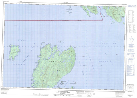
103J10 Dundas Island Canada topo map, 1:50,000 scale
103J10 Dundas Island NRCAN topographic map.
Includes UTM and GPS geographic coordinates (latitude and longitude). This 50k scale map is suitable for hiking, camping, and exploring, or you could frame it as a wall map.
Printed on-demand using high resolution, on heavy weight and acid free paper, or as an upgrade on a variety of synthetic materials.
Topos available on paper, Waterproof, Poly, or Tyvek. Usually shipping rolled, unless combined with other folded maps in one order.
- Product Number: NRCAN-103J10
- Parent Topo: TOPO-103J
- Map ID also known as: 103J10
- Unfolded Size: Approximately 26" high by 36" wide
- Weight (paper map): ca. 55 grams
- Map Type: POD NRCAN Topographic Map
- Map Scale: 1:50,000
- Geographical region: British Columbia, Canada
Neighboring Maps:
All neighboring Canadian topo maps are available for sale online at 1:50,000 scale.
Purchase the smaller scale map covering this area: Topo-103J
Spatial coverage:
Topo map sheet 103J10 Dundas Island covers the following places:
- Boat Harbour - Brundige Inlet - Goose Bay - Wales Harbour - Aranzazu Point - Arniston Point - Jacinto Point - Prospector Point - Whitly Point - Caamaño Passage - Dixon Entrance - Holliday Passage - Hudson Bay Passage - Main Passage - Oriflamme Passage - Tongass Passage - Channel Islands Indian Reserve 33 - Dundas Island Indian Reserve 32B - Ksadsks Indian Reserve 44 - Réserve indienne Channel Islands 33 - Réserve indienne Dundas Island 32B - Réserve indienne Ksadsks 44 - Réserve indienne Zayas Island 32A - Zayas Island Indian Reserve 32A - Boston Islands - Ducie Island - Ducie Islet - Dundas Island - Dundas Islands - Fitch Island - Gnarled Islands - Green Island - Grey Island - Grey Islet - Haystack Island - Holliday Island - Proctor Islands - Randall Island - Tracy Island - Wales Island - White Islets - Whitesand Island - Zayas Island - Boundary Ranges - Kitimat Ranges - Mount Bonwick - Mount Henry - Slab Hill - Table Hill - Regional District of Kitimat-Stikine - Bristol Rock - Brodie Rock - Connis Rocks - East Devil Rock - Pointer Rocks


