
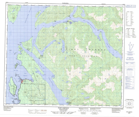
103J09 Port Simpson Canada topo map, 1:50,000 scale
103J09 Port Simpson NRCAN topographic map.
Includes UTM and GPS geographic coordinates (latitude and longitude). This 50k scale map is suitable for hiking, camping, and exploring, or you could frame it as a wall map.
Printed on-demand using high resolution, on heavy weight and acid free paper, or as an upgrade on a variety of synthetic materials.
Topos available on paper, Waterproof, Poly, or Tyvek. Usually shipping rolled, unless combined with other folded maps in one order.
- Product Number: NRCAN-103J09
- Parent Topo: TOPO-103J
- Map ID also known as: 103J09, 103J9
- Unfolded Size: Approximately 26" high by 36" wide
- Weight (paper map): ca. 55 grams
- Map Type: POD NRCAN Topographic Map
- Map Scale: 1:50,000
- Geographical region: British Columbia, Canada
Neighboring Maps:
All neighboring Canadian topo maps are available for sale online at 1:50,000 scale.
Purchase the smaller scale map covering this area: Topo-103J
Spatial coverage:
Topo map sheet 103J09 Port Simpson covers the following places:
- Chatham Sound - Eagle Bight - Grave Bay - Khutzeymateen Inlet - Kumeon Bay - Legace Bay - Otter Anchorage - Pearl Harbour - Port Simpson - Portland Inlet - Quottoon Inlet - Stumaun Bay - Trail Bay - Tsamspanaknok Bay - Union Bay - Union Inlet - Worsfold Bay - Zumtela Bay - Bath Point - Cook Point - Duncan Point - Elliott Point - Emma Point - Father Point - Flewin Point - Fortune Point - Gordon Point - Grace Point - Grassy Point - Hay Point - Hook Point - John Point - Keemein Point - Knox Point - Lama Point - Maskelyne Point - McGregor Point - Picnic Point - Red Cliff Point - Redcliff Point - Rock Point - Sarah Point - Spakels Point - Trounce Point - Tsimpsean Peninsula - Wales Point - Walskakul Point - Welgeegenk Point - Boat Passage - Cunningham Passage - Dodd Passage - Dudevoir Passage - Emma Passage - Inskip Passage - North Arm of Work Channel - Paradise Passage - Rushbrook Passage - Steamer Passage - Truro Passage - Wark Channel - Work Channel - Birnie Island Indian Reserve 18 - Ensheshese Indian Reserve 13 - Ensheshese Indian Reserve 53 - Finlayson Island Indian Reserve 19 - Knamadeek Indian Reserve 52 - Ksabasn Indian Reserve 50 - Ktamgaodzen Indian Reserve 51 - Lax Kw'alaams 1 - Lax Kw'alaams Indian Reserve 1 - Me-yan-law Indian Reserve 47 - Port Simpson Indian Reserve 1 - Réserve indienne Birnie Island 18 - Réserve indienne Ensheshese 13 - Réserve indienne Ensheshese 53 - Réserve indienne Finlayson Island 19 - Réserve indienne Knamadeek 52 - Réserve indienne Ksabasn 50 - Réserve indienne Ktamgaodzen 51 - Réserve indienne Lax Kw'alaams 1 - Réserve indienne Me-yan-law 47 - Réserve indienne Port Simpson 1 - Réserve indienne Spakels 17 - Réserve indienne Spokwan 48 - Réserve indienne Tsimpsean 2 - Réserve indienne Tymgowzan 12 - Réserve indienne Union Bay 31 - S1/2 Tsimpsean 2 - Spakels Indian Reserve 17 - Spokwan Indian Reserve 48 - Tsimpsean Indian Reserve 2 - Tymgowzan Indian Reserve 12 - Union Bay Indian Reserve 31 - Birnie Island - Finlayson Island - Flat Top Islands - Hogan Island - Maskelyne Island - Mist Island - Nob Islet - One Tree Island - One Tree Islet - Parkin Islets - Rose Island - Somerville Island - Truro Island - Village Island - Wales Island - Crow Lagoon - Crow Lake - Ensheshese Lake - Little Union Lake - Ndakdolk Lake - Neaxtoalk Lake - Sarah Lake - Union Lake - Chaîne Côtière - Coast Mountains - Entry Peak - George Hill - Kitimat Ranges - Leading Peak - Lizzie Hill - Mount Ben - Mount Griffin - Mount McNeil - Town Hill - Regional District of Kitimat-Stikine - Bear Creek - Ensheshese River - Legiac Creek - McShane Creek - Mouse Creek - Salmon Creek - Stumaun Creek - Talahaat Creek - Union Creek - Barrat Shoal - Centre Rock - Datum Rock - Dodd Rock - Hankin Reefs - Harbour Reefs - Pender Rock - Pinnacle Rock - Sager Rock - Sparrowhawk Rock - Walskakul Shoal - Lax Kw'alaams - Port Simpson


