
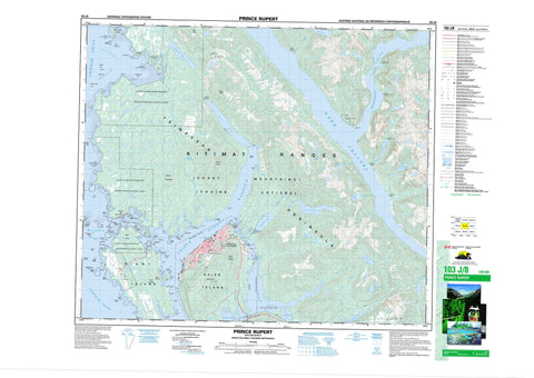
103J08 Prince Rupert Canada topo map, 1:50,000 scale
103J08 Prince Rupert NRCAN topographic map.
Includes UTM and GPS geographic coordinates (latitude and longitude). This 50k scale map is suitable for hiking, camping, and exploring, or you could frame it as a wall map.
Printed on-demand using high resolution, on heavy weight and acid free paper, or as an upgrade on a variety of synthetic materials.
Topos available on paper, Waterproof, Poly, or Tyvek. Usually shipping rolled, unless combined with other folded maps in one order.
- Product Number: NRCAN-103J08
- Parent Topo: TOPO-103J
- Map ID also known as: 103J08, 103J8
- Unfolded Size: Approximately 26" high by 36" wide
- Weight (paper map): ca. 55 grams
- Map Type: POD NRCAN Topographic Map
- Map Scale: 1:50,000
- Geographical region: British Columbia, Canada
Neighboring Maps:
All neighboring Canadian topo maps are available for sale online at 1:50,000 scale.
Purchase the smaller scale map covering this area: Topo-103J
Spatial coverage:
Topo map sheet 103J08 Prince Rupert covers the following places:
- Bacon Cove - Big Bay - Boundary Cove - Casey Cove - Chatham Sound - Cow Bay - Crippen Cove - Delusion Bay - Denise Arm - Denise Inlet - Dodge Cove - Duncan Bay - Hays Cove - Hill Cove - Hospital Cove - Kloiya Bay - Laurier Cove - Melville Arm - Metlakatla Bay - Miller Bay - Morse Basin - Osborn Cove - Philips Cove - Pillsbury Cove - Prince Rupert Harbour - Quottoon Inlet - Russell Arm - Salmon Bight - Salmon River Bight - Scott Inlet - Seal Cove - Shkgeaum Bay - Sourdough Bay - Tuck Inlet - Wainwright Basin - Auriol Point - Bacon Point - Beatty Point - Belletti Point - Butze Point - Camp Point - Casey Point - Charles Point - Cultivation Point - David Point - de Stein Point - De Stein Point - Doolan Point - Douglas Point - Du Vernet Point - Dundas Point - East Base Point - Elizabeth Point - Emmerson Point - Fairview Point - Frederick Point - Grindstone Point - Henry Point - Jap Point - Miller Point - Mission Point - Observation Point - Parizeau Point - Pattullo Point - Pearl Point - Pepin Point - Pethick Point - Philips Point - Pillsbury Point - Quottoon Point - Reeks Point - Reservation Point - Ritchie Point - Roberson Point - Russell Point - Ryan Point - Schreiber Point - Shattock Point - Simpson Point - Straith Point - Tobey Point - Trenham Point - Tsimpsean Peninsula - Tuck Point - West Base Point - Fern Passage - North Arm of Work Channel - North Passage - Quottoon Narrows - South Passage - Tuck Narrows - Venn Passage - Wark Channel - Work Channel - Prince Rupert - Tree Bluff - Bill Lake Indian Reserve 37 - Burnt Cliff Islands Indian Reserve 20 - Kasika Indian Reserve 36 - Lax Kw'alaams 1 - Lax Kw'alaams Indian Reserve 1 - Ndakdolk Indian Reserve 54 - Nishanocknawnak Indian Reserve 35 - Port Simpson Indian Reserve 1 - Réserve indienne Bill Lake 37 - Réserve indienne Burnt Cliff Islands 20 - Réserve indienne Kasika 36 - Réserve indienne Lax Kw'alaams 1 - Réserve indienne Ndakdolk 54 - Réserve indienne Nishanocknawnak 35 - Réserve indienne Port Simpson 1 - Réserve indienne Shoowahtlans (Shawtlans) 4 - Réserve indienne Spanaknok 57 - Réserve indienne Spayaks 60 - Réserve indienne Tsimpsean 2 - Réserve indienne Tuck Inlet 89 - Réserve indienne Tugwell Island 21 - Réserve indienne Wilnaskancaud 3 - Réserve indienne Wilskaskammel 14 - S1/2 Tsimpsean 2 - Shoowahtlans (Shawtlans) Indian Reserve 4 - Spanaknok Indian Reserve 57 - Spayaks Indian Reserve 60 - Tsimpsean Indian Reserve 2 - Tuck Inlet Indian Reserve 89 - Tugwell Island Indian Reserve 21 - Wilnaskancaud Indian Reserve 3 - Wilskaskammel Indian Reserve 14 - Anian Island - Burnt Cliff Island - Burrowes Island - Carolina Island - Carolina Islands - Carr Island - Cridge Island - Detention Island - Devastation Island - Digby Island - Dodge Island - Garden Island - Gribbell Islet - Grindstone Island - Haycock Island - Hill Island - Isabel Islet - Kaien Island - Knight Island - Little Cridge Island - Martini Island - Naden Islets - Pike Island - Ritchie Island - Shrub Island - Snider Islet - South Island - Swallow Island - Swamp Island - Tugwell Island - Verney Island - Vigilant Island - White Cliff Island - Whitecliff Island - Wilgiapshi Island - Wolfe Island - Bannock Lake - Bencke Lagoon - Bill Lake - Dudoward Lake - Georgetown Lake - Gilroy Lake - Kergin Lake - Louise Lake - Mahlon Lake - Marion Lake - Ndakdolk Lake - Oliver Lake - Prudhomme Lake - Salt Lake - Sarah Lake - Shawatlan Lake - Tsook Lake - Woodworth Lake - Basil Lump - Chaîne Côtière - Coast Mountains - Keen Hills - Kitimat Ranges - Mission Mountain - Mount Comblain - Mount Hays - Mount Morse - Mount Oldfield - Prospect Hill - Sharp Peak - Shattock Hill - Oliver Lake Park - Prudhomme Lake Park - Salt Lake Park - Butze Rapids - Bill Creek - Denise Creek - Fortune Creek - Georgetown Creek - Gilroy Creek - Hays Creek - Kaien Creek - Kloiya River - Large Creek - Louise Creek - Marion Creek - McNichol Creek - McShane Creek - Morse Creek - Sarah Creek - Scissors Creek - Shawatlan River - Silver Creek - Galloway Rapids - Alford Reefs - Anchor Shoal - Armour Rock - Arthur Rock - Clutch Rock - Curlew Rock - Cutch Rock - Entry Rock - Escape Reefs - Hecate Rock - Hogan Ledge - Kelp Reef - Kelp Rock - Kerr Rocks - Leading Shoal - McIntosh Rock - Midge Rock - One Foot Rock - Quartermaster Rock - Ripple Bank - Scattered Reefs - Slippery Rock - Snider Rock - Stork Rock - Digby Island - Digby Island - Dodge Cove - Georgetown Mills - Metlakatla - Norwegian Village - Oldfield


