
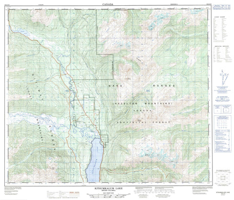
103I15 Kitsumkalum Lake Canada topo map, 1:50,000 scale
103I15 Kitsumkalum Lake NRCAN topographic map.
Includes UTM and GPS geographic coordinates (latitude and longitude). This 50k scale map is suitable for hiking, camping, and exploring, or you could frame it as a wall map.
Printed on-demand using high resolution, on heavy weight and acid free paper, or as an upgrade on a variety of synthetic materials.
Topos available on paper, Waterproof, Poly, or Tyvek. Usually shipping rolled, unless combined with other folded maps in one order.
- Product Number: NRCAN-103I15
- Parent Topo: TOPO-103I
- Map ID also known as: 103I15
- Unfolded Size: Approximately 26" high by 36" wide
- Weight (paper map): ca. 55 grams
- Map Type: POD NRCAN Topographic Map
- Map Scale: 1:50,000
- Geographical region: British Columbia, Canada
Neighboring Maps:
All neighboring Canadian topo maps are available for sale online at 1:50,000 scale.
Purchase the smaller scale map covering this area: Topo-103I
Spatial coverage:
Topo map sheet 103I15 Kitsumkalum Lake covers the following places:
- North Arm of Work Channel - West Haycock Island - Gainor Lake - Kitsumgallum Lake - Kitsumkalum Lake - Sand Lake - Chaîne Côtière - Coast Mountains - Hazelton Mountains - Kitimat Ranges - Maroon Mountain - Mount Allard - Mount Couture - Nass Range - Nass Ranges - Pimple Peak - Wesach Mountain - Regional District of Kitimat-Stikine - Belway Creek - Cedar River - Clarence Creek - Clear Creek - Douglas Creek - Egan Creek - Fiddler Creek - Hadenschild Creek - Hall Creek - Hammersley Creek - Hampson Creek - Insect Creek - Johnson Creek - Kitsumgallum River - Kitsumkalum River - Little Cedar River - Lorne Creek - Maroon Creek - Mayo Creek - Meadow Creek - Porcupine Creek - Quill Creek - South Lorne Creek - Sterling Creek - Tseax River - Wesach Creek - Rosswood


