
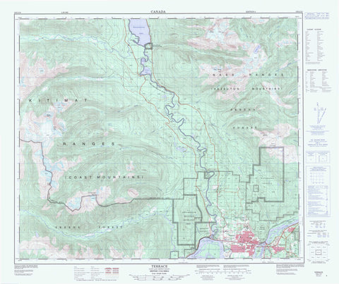
103I10 Terrace Canada topo map, 1:50,000 scale
103I10 Terrace NRCAN topographic map.
Includes UTM and GPS geographic coordinates (latitude and longitude). This 50k scale map is suitable for hiking, camping, and exploring, or you could frame it as a wall map.
Printed on-demand using high resolution, on heavy weight and acid free paper, or as an upgrade on a variety of synthetic materials.
Topos available on paper, Waterproof, Poly, or Tyvek. Usually shipping rolled, unless combined with other folded maps in one order.
- Product Number: NRCAN-103I10
- Parent Topo: TOPO-103I
- Map ID also known as: 103I10
- Unfolded Size: Approximately 26" high by 36" wide
- Weight (paper map): ca. 55 grams
- Map Type: POD NRCAN Topographic Map
- Map Scale: 1:50,000
- Geographical region: British Columbia, Canada
Neighboring Maps:
All neighboring Canadian topo maps are available for sale online at 1:50,000 scale.
Purchase the smaller scale map covering this area: Topo-103I
Spatial coverage:
Topo map sheet 103I10 Terrace covers the following places:
- Terrace - Dalk-ka-gila-quoeux Indian Reserve 2 - Kitsumkaylum Indian Reserve 1 - Réserve indienne Dalk-ka-gila-quoeux 2 - Réserve indienne Kitsumkaylum 1 - Brauns Island - Ferry Island - Little Island - Schremp Island - Fiddler Lake - Kitsumgallum Lake - Kitsumkalum Lake - Mud Lake - Pine Lake - Redsand Lake - Treston Lake - Alice Peak - Chaîne Côtière - Coast Mountains - Glacier Peak - Hazelton Mountains - Kitimat Ranges - Kitsumkalum Mountain - Lean-to Mountain - Mount Garland - Mount Kenney - Mount Terrace - Mount Treston - Mount Treston - Mount Vanarsdol - Mount Vanarsdoll - Nass Range - Nass Ranges - Sleeping Beauty Mountain - Terrace Mountain - Regional District of Kitimat-Stikine - Kitsumkalum Mountain Recreation Area - Kitsumkalum Park - Terrace Park - Alice Creek - Deep Creek - Eneeksaguilaguaw Creek - Erlandsen Creek - Fiddler Creek - Glacier Creek - Goat Creek - Hankin Creek - Hardscrabble Creek - Kerr Channel - Kitsumgallum River - Kitsumkalum River - Lean-to Creek - Lowrie Creek - Luncheon Creek - Maroon Creek - Molybdenum Creek - Neaksagilaguaw Creek - Nelson River - Newtown Creek - Pontoon Creek - Shannon Creek - Skeena River - Spring Creek - Star Creek - Steinhoe Creek - Thornhill Creek - Zymagotitz River - Kallum - Kitsumgallum - Kitsumkalum - Thornhill


