
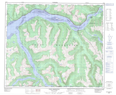
103I04 Port Essington Canada topo map, 1:50,000 scale
103I04 Port Essington NRCAN topographic map.
Includes UTM and GPS geographic coordinates (latitude and longitude). This 50k scale map is suitable for hiking, camping, and exploring, or you could frame it as a wall map.
Printed on-demand using high resolution, on heavy weight and acid free paper, or as an upgrade on a variety of synthetic materials.
Topos available on paper, Waterproof, Poly, or Tyvek. Usually shipping rolled, unless combined with other folded maps in one order.
- Product Number: NRCAN-103I04
- Parent Topo: TOPO-103I
- Map ID also known as: 103I04, 103I4
- Unfolded Size: Approximately 26" high by 36" wide
- Weight (paper map): ca. 55 grams
- Map Type: POD NRCAN Topographic Map
- Map Scale: 1:50,000
- Geographical region: British Columbia, Canada
Neighboring Maps:
All neighboring Canadian topo maps are available for sale online at 1:50,000 scale.
Purchase the smaller scale map covering this area: Topo-103I
Spatial coverage:
Topo map sheet 103I04 Port Essington covers the following places:
- Aberdeen Point - Carthew Point - Granulite Point - Hotspring Point - Khyex Point - McLean Point - Snag Point - Telegraph Point - Windsor Point - Raspberry Bluff - Imkusiyan Indian Reserve 65 - Imkusiyan Indian Reserve 66 - Khtahda Indian Reserve 10 - Khyex Indian Reserve 8 - Kilcutseen Indian Reserve 9 - Port Essington Indian Reserve - Réserve indienne Imkusiyan 65 - Réserve indienne Imkusiyan 66 - Réserve indienne Khtahda 10 - Réserve indienne Khyex 8 - Réserve indienne Kilcutseen 9 - Réserve indienne Port Essington - Réserve indienne Scuttsap 11 - Réserve indienne Scuttsap 11A - Scuttsap Indian Reserve 11 - Scuttsap Indian Reserve 11A - Ayton Island - Carnation Island - Ecstall Island - Raspberry Islands - Selma Island - Beaver Lake - Big Falls Lake - Brown Lake - Cunningham Lake - Davis Lake - Hayward Lake - Khtada Lake - McKnight Lake - Orde Slough - Balmoral Peak - Chaîne Côtière - Coast Mountains - Kitimat Ranges - Morrison Mountain - Mount Hayward - Mount McLean - Mount Morrison - Skip Mountain - Spinel Peak - Spokshute Mountain - Aberdeen Creek - Antigonish Creek - Ayton Creek - Beaver Creek - Big Falls Creek - Camp Creek - Carthew Creek - Cuthbert Creek - Ecstall River - Feak Creek - Gamble Creek - Hayward Creek - Inver Creek - Khtada River - Khyex River - Kwinitsa Creek - Kwinitsa River - Little Beaver Creek - McDonald Creek - McKnight Creek - McNeil River - Miller Creek - Scotia River - Skeena River - Stapledon Creek - Windsor River - Ayton Bank - Carnation Bank - Herman Rock - Khyex Bank - Skeena Banks - Skip Rock - Tyee Bank - Walsh Bank - Frizzell Hotsprings - Alexander - Alexandra - Essington - Kwinitsa - Port Essington - Skeena - Skeena City - Telegraph Point - Tyee


