
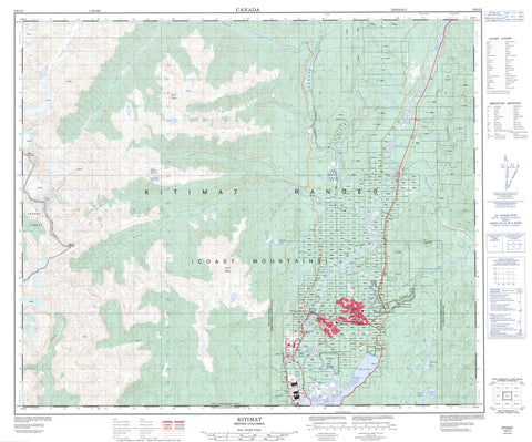
103I02 Kitimat Canada topo map, 1:50,000 scale
103I02 Kitimat NRCAN topographic map.
Includes UTM and GPS geographic coordinates (latitude and longitude). This 50k scale map is suitable for hiking, camping, and exploring, or you could frame it as a wall map.
Printed on-demand using high resolution, on heavy weight and acid free paper, or as an upgrade on a variety of synthetic materials.
Topos available on paper, Waterproof, Poly, or Tyvek. Usually shipping rolled, unless combined with other folded maps in one order.
- Product Number: NRCAN-103I02
- Parent Topo: TOPO-103I
- Map ID also known as: 103I02, 103I2
- Unfolded Size: Approximately 26" high by 36" wide
- Weight (paper map): ca. 55 grams
- Map Type: POD NRCAN Topographic Map
- Map Scale: 1:50,000
- Geographical region: British Columbia, Canada
Neighboring Maps:
All neighboring Canadian topo maps are available for sale online at 1:50,000 scale.
Purchase the smaller scale map covering this area: Topo-103I
Spatial coverage:
Topo map sheet 103I02 Kitimat covers the following places:
- Kitimat Arm - Kitimat Harbour - Minette Bay - Kitimat - Jugwees (Minette Bay) Indian Reserve 5 - Kitamaat Indian Reserve 1 - Kitimat (Colichan Ground or Old Town) Indian Reserve 1 - Klak-ak-siouks Indian Reserve 9 - Réserve indienne Jugwees (Minette Bay) 5 - Réserve indienne Kitamaat 1 - Réserve indienne Kitimat (Colichan Ground or Old Town) 1 - Réserve indienne Klak-ak-siouks 9 - Réserve indienne Tsinqueise (Minette Bay) 5 - Tsinqueise (Minette Bay) Indian Reserve 5 - Bish Lake - Bowbyes Lake - Kitelse Lake - Lasha Lake - Robinson Lake - Chaîne Côtière - Claque Mountain - Coast Mountains - Fire Mountain - Iron Mountain - Kitimat Ranges - Mount Charlie - Mount Clague - Mount Holt - Mount Madden - Mount Temple - Regional District of Kitimat-Stikine - Gitnadoix River Recreation Area - Hirsch Creek Park - Anderson Creek - Aveling Creek - Bish Creek - Bolton Creek - Bowbyes Creek - Canyon Creek - Cecil Creek - Cordella Creek - Cordella Creek - Dahl Creek - Deception Creek - Hirsch Creek - Humphrys Creek - Iron Mine Creek - Jack Pine Creek - Jesse Creek - Kitimat River - Little Wedeene River - Lone Wolf Creek - Lukes Creek - McCullough Creek - Minette Bay Creek - Moore Creek - Morrison Creek - Nalbeelah Creek - Pine Creek - Railey Creek - Raley Creek - Stony Creek - Sumgás Creek - Wedeene River - Nechako - Nechako Centre - Wedeene


