
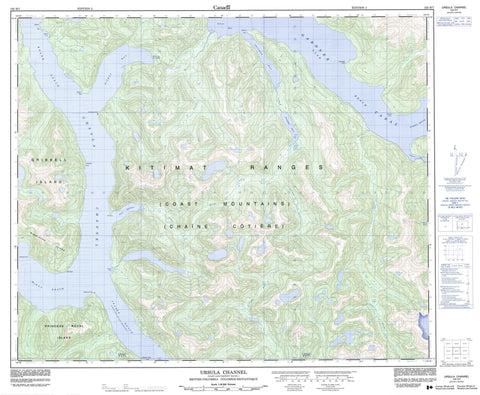
103H07 Ursula Channel Canada topo map, 1:50,000 scale
103H07 Ursula Channel NRCAN topographic map.
Includes UTM and GPS geographic coordinates (latitude and longitude). This 50k scale map is suitable for hiking, camping, and exploring, or you could frame it as a wall map.
Printed on-demand using high resolution, on heavy weight and acid free paper, or as an upgrade on a variety of synthetic materials.
Topos available on paper, Waterproof, Poly, or Tyvek. Usually shipping rolled, unless combined with other folded maps in one order.
- Product Number: NRCAN-103H07
- Parent Topo: TOPO-103H
- Map ID also known as: 103H07, 103H7
- Unfolded Size: Approximately 26" high by 36" wide
- Weight (paper map): ca. 55 grams
- Map Type: POD NRCAN Topographic Map
- Map Scale: 1:50,000
- Geographical region: British Columbia, Canada
Neighboring Maps:
All neighboring Canadian topo maps are available for sale online at 1:50,000 scale.
Purchase the smaller scale map covering this area: Topo-103H
Spatial coverage:
Topo map sheet 103H07 Ursula Channel covers the following places:
- Angler Cove - Bishop Bay - Bishop Cove - Fisherman Cove - Goat Harbour - Kiltuish Inlet - Ochwe Bay - Triumph Bay - Monkey Beach - Egerton Point - Elephant Head Point - Europa Point - Fellbrook Point - Kid Point - Kingcome Point - Low Point - Pilot Point - Richardson Point - Riordan Point - Shearwater Point - Shephard Point - Shepherd Point - Tomkinson Point - Walkem Point - Gardner Canal - Princess Royal Channel - Ursula Channel - Crew Island - Gribbell Island - Princess Royal Island - Triumph Lake - Chaîne Côtière - Coast Mountains - Kitimat Ranges - Wimbledon Mountains - Wimbledon Range - Regional District of Kitimat-Stikine - Aaltanhash River - Europa Creek - Goat River - Klekane River - Paril River - Triumph River - Alan Reach - Boxer Reach - Europa Reach - Fraser Reach - McKay Reach - Bishop Bay Hot Springs


