
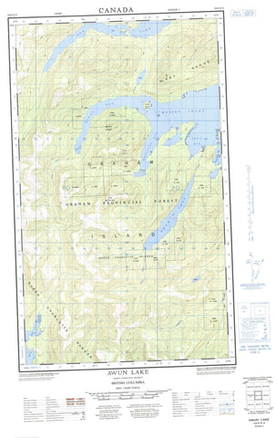
103F10E Awun Lake Canada topo map, 1:50,000 scale
103F10E Awun Lake NRCAN topographic map.
Includes UTM and GPS geographic coordinates (latitude and longitude). This 50k scale map is suitable for hiking, camping, and exploring, or you could frame it as a wall map.
Printed on-demand using high resolution, on heavy weight and acid free paper, or as an upgrade on a variety of synthetic materials.
Topos available on paper, Waterproof, Poly, or Tyvek. Usually shipping rolled, unless combined with other folded maps in one order.
- Halfsheet: This map was designed as a half sheet of NRCAN-103F10, and it is the Eastern half. Find the western half sheet here.
- Product Number: NRCAN-103F10E
- Parent Topo: TOPO-103F
- Map ID also known as: 103F10
- Unfolded Size: Approximately 26" high by 36" wide
- Weight (paper map): ca. 55 grams
- Map Type: POD NRCAN Topographic Map
- Map Scale: 1:50,000
- Geographical region: British Columbia, Canada
Neighboring Maps:
All neighboring Canadian topo maps are available for sale online at 1:50,000 scale.
Purchase the smaller scale map covering this area: Topo-103F
Spatial coverage:
Topo map sheet 103F10E Awun Lake covers the following places:
- Athlow Bay - Awun Bay - Dinan Bay - Empire Anchorage - Goose Cove - Hosu Cove - Kiokathli Inlet - Masset Inlet - McClinton Bay - Nesto Inlet - North Cove - Port Chanal - Port Louis - Seal Inlet - Shannon Bay - Skelu Bay - Tingley Cove - Virgalias Cove - Alured Point - Chanal Point - Gillan Point - Hippa Point - Hughes Point - Louis Point - Marchand Point - McIntosh Point - Notch Point - Salvesen Point - Selvesen Point - Skelu Point - Turner Point - Hippa Passage - Celestial Bluff - Owun Indian Reserve 24 - Réserve indienne Owun 24 - Barry Island - Brock Islands - Freeman Island - Graham Island - Hippa Island - Îles de la Reine-Charlotte - Mackenzie Island - Mutus Island - Ogilvie Island - Pip Islets - Queen Charlotte Islands - Queen Island - Sadler Island - Salvesen Island - Selvesen Island - Solide Islands - Wiah Island - Awun Lake - Ian Lake - Mercer Lake - Cameron Range - Davie Peak - Fortier Hill - Ironside Mountain - McKay Range - Mount Drake - Mount Hobbs - Mount Ironside - Queen Charlotte Mountains - Tan Mountain - Skidegate Plateau - Awun River - Coates Creek - Datlamen Creek - Dinan Creek - Mace Creek - McClinton Creek - Steel Creek - Tatzun Brook - Tatzun Creek - Barnes Shoal - Benson Rock - Chanal Rock - Flamingo Rock - Hippa Rocks - Louis Rocks - Mallard Rock - Newington Rock - Quequitz Reefs - Taylor Shoal - Thomas Rock - Hippa


