
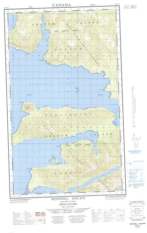
103F07E Rennell Sound Canada topo map, 1:50,000 scale
103F07E Rennell Sound NRCAN topographic map.
Includes UTM and GPS geographic coordinates (latitude and longitude). This 50k scale map is suitable for hiking, camping, and exploring, or you could frame it as a wall map.
Printed on-demand using high resolution, on heavy weight and acid free paper, or as an upgrade on a variety of synthetic materials.
Topos available on paper, Waterproof, Poly, or Tyvek. Usually shipping rolled, unless combined with other folded maps in one order.
- Halfsheet: This map was designed as a half sheet of NRCAN-103F07, and it is the Eastern half. Find the western half sheet here.
- Product Number: NRCAN-103F07E
- Parent Topo: TOPO-103F
- Map ID also known as: 103F07, 103F7
- Unfolded Size: Approximately 26" high by 36" wide
- Weight (paper map): ca. 55 grams
- Map Type: POD NRCAN Topographic Map
- Map Scale: 1:50,000
- Geographical region: British Columbia, Canada
Neighboring Maps:
All neighboring Canadian topo maps are available for sale online at 1:50,000 scale.
Purchase the smaller scale map covering this area: Topo-103F
Spatial coverage:
Topo map sheet 103F07E Rennell Sound covers the following places:
- Carew Bay - Clonard Bay - Givenchy Anchorage - Kano Inlet - Seal Inlet - Shields Bay - Skelu Bay - Tartoo Inlet - Tartu Inlet - Van Harbour - Van Inlet - Clonard Point - Cone Head - Fame Point - Gospel Point - Hunter Point - Kano Point - Kindakun Point - Kunakun Point - Richardson Head - Seal Point - Skwakadanee Point - Tartu Point - Cartwright Sound - Rennell Sound - Cadman Island - Gospel Island - Graham Island - Îles de la Reine-Charlotte - Lauder Island - Queen Charlotte Islands - Sadler Island - Mount Emmons - Queen Charlotte Mountains - Skidegate Plateau - Riley Creek - Freeman Rock - Kindakun Rock - Rennell Reef


