
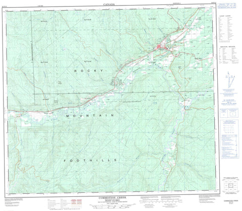
093P12 Commotion Creek Canada topo map, 1:50,000 scale
093P12 Commotion Creek NRCAN topographic map.
Includes UTM and GPS geographic coordinates (latitude and longitude). This 50k scale map is suitable for hiking, camping, and exploring, or you could frame it as a wall map.
Printed on-demand using high resolution, on heavy weight and acid free paper, or as an upgrade on a variety of synthetic materials.
Topos available on paper, Waterproof, Poly, or Tyvek. Usually shipping rolled, unless combined with other folded maps in one order.
- Product Number: NRCAN-093P12
- Parent Topo: TOPO-093P
- Map ID also known as: 093P12, 93P12
- Unfolded Size: Approximately 26" high by 36" wide
- Weight (paper map): ca. 55 grams
- Map Type: POD NRCAN Topographic Map
- Map Scale: 1:50,000
- Geographical region: British Columbia, Canada
Neighboring Maps:
All neighboring Canadian topo maps are available for sale online at 1:50,000 scale.
Purchase the smaller scale map covering this area: Topo-093P
Spatial coverage:
Topo map sheet 093P12 Commotion Creek covers the following places:
- Chetwynd - Carl Lake - Cruiser Mountain - Mount Wabi - Rocky Mountain Foothills - Submarine Mountain - Peace River Regional District - Benson Creek - Bissett Creek - Bowlder Creek - Carl Creek - Caron Creek - Centurion Creek - Commotion Creek - Dickebusch Creek - Dokie Creek - Fernando Creek - Goodrich Creek - Hasler Creek - Highhat River - Johnsen Creek - Johnson Creek - Pine River - Pys Creek - Stanley Creek - Stone Creek - Sukunka River - Wabi Creek - Walton Creek - Widmark Creek - Wildmare Creek - Wilkie Creek - Windrem Creek - Young Creek - Zonnebeke Creek - Commotion Creek - Dokie - Dokie Siding - Hasler - Hasler Flat - Little Prairie - Pinesul - Twidwell Bend


