
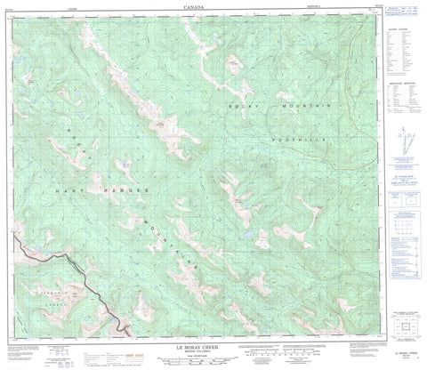
093O08 Le Moray Creek Canada topo map, 1:50,000 scale
093O08 Le Moray Creek NRCAN topographic map.
Includes UTM and GPS geographic coordinates (latitude and longitude). This 50k scale map is suitable for hiking, camping, and exploring, or you could frame it as a wall map.
Printed on-demand using high resolution, on heavy weight and acid free paper, or as an upgrade on a variety of synthetic materials.
Topos available on paper, Waterproof, Poly, or Tyvek. Usually shipping rolled, unless combined with other folded maps in one order.
- Product Number: NRCAN-093O08
- Parent Topo: TOPO-093O
- Map ID also known as: 093O08, 93O8, 93O08
- Unfolded Size: Approximately 26" high by 36" wide
- Weight (paper map): ca. 55 grams
- Map Type: POD NRCAN Topographic Map
- Map Scale: 1:50,000
- Geographical region: British Columbia, Canada
Neighboring Maps:
All neighboring Canadian topo maps are available for sale online at 1:50,000 scale.
Purchase the smaller scale map covering this area: Topo-093O
Spatial coverage:
Topo map sheet 093O08 Le Moray Creek covers the following places:
- Iver Lake - Otto Lake - Brazion Peak - Goodrich Peak - Hart Ranges - Howling Wolves Peak - Milburn Peak - Misinchinka Ranges - Montagnes Rocheuses - Mount Gilliland - Mount Hunter - Mount Le Hudette - Mount Le Moray - Mount Stephenson - Murray Range - Rocky Mountain Foothills - Rocky Mountains - Peace River Regional District - Annie Creek - Beaudette Creek - Benjamin Creek - Brazion Creek - Burnt River - Falling Creek - Hasler Creek - Isabella Creek - Iver Creek - Le Moray Creek - Misinchinka River - Mountain Creek - North Burnt River - Stack Creek - Tuck Creek


