
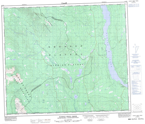
093M02 Harold Price Creek Canada topo map, 1:50,000 scale
093M02 Harold Price Creek NRCAN topographic map.
Includes UTM and GPS geographic coordinates (latitude and longitude). This 50k scale map is suitable for hiking, camping, and exploring, or you could frame it as a wall map.
Printed on-demand using high resolution, on heavy weight and acid free paper, or as an upgrade on a variety of synthetic materials.
Topos available on paper, Waterproof, Poly, or Tyvek. Usually shipping rolled, unless combined with other folded maps in one order.
- Product Number: NRCAN-093M02
- Parent Topo: TOPO-093M
- Map ID also known as: 093M02, 93M2, 93M02
- Unfolded Size: Approximately 26" high by 36" wide
- Weight (paper map): ca. 55 grams
- Map Type: POD NRCAN Topographic Map
- Map Scale: 1:50,000
- Geographical region: British Columbia, Canada
Neighboring Maps:
All neighboring Canadian topo maps are available for sale online at 1:50,000 scale.
Purchase the smaller scale map covering this area: Topo-093M
Spatial coverage:
Topo map sheet 093M02 Harold Price Creek covers the following places:
- Réserve indienne Tadinlay 15 - Réserve indienne Tsak 9 - Tadinlay Indian Reserve 15 - Tsak Indian Reserve 9 - Babine Lake - Bristol Lake - Holland Lake - Torkelsen Lake - Wan Lake - Babine Mountains - Babine Range - Skeena Mountains - Regional District of Bulkley-Nechako - Regional District of Kitimat-Stikine - Babine Mountains Recreation Area - Interior Plateau - Nechako Plateau - Blunt Creek - Bristol Creek - Cain Creek - Camp Creek - Debenture Creek - Fulton River - Harold Price Creek - Howal Creek - Keulsh Creek - Luhk Creek - Maish Creek - Moan Creek - Netalzul Creek - Paask Creek - Shummi Creek - Taka Creek - Torkelsen Creek - Touhy Creek - Tsouts Creek - Williams Creek - Smithers Landing


