
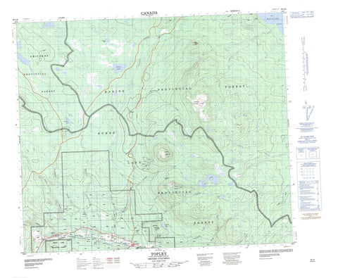
093L09 Topley Canada topo map, 1:50,000 scale
093L09 Topley NRCAN topographic map.
Includes UTM and GPS geographic coordinates (latitude and longitude). This 50k scale map is suitable for hiking, camping, and exploring, or you could frame it as a wall map.
Printed on-demand using high resolution, on heavy weight and acid free paper, or as an upgrade on a variety of synthetic materials.
Topos available on paper, Waterproof, Poly, or Tyvek. Usually shipping rolled, unless combined with other folded maps in one order.
- Product Number: NRCAN-093L09
- Parent Topo: TOPO-093L
- Map ID also known as: 093L09, 93L9, 93L09
- Unfolded Size: Approximately 26" high by 36" wide
- Weight (paper map): ca. 55 grams
- Map Type: POD NRCAN Topographic Map
- Map Scale: 1:50,000
- Geographical region: British Columbia, Canada
Neighboring Maps:
All neighboring Canadian topo maps are available for sale online at 1:50,000 scale.
Purchase the smaller scale map covering this area: Topo-093L
Spatial coverage:
Topo map sheet 093L09 Topley covers the following places:
- Lunch Point - Ailport Lake - Babine Lake - Baboon Lake - Cesford Lake - Cobham Lake - Findlay Lake - Lennac Lake - Nez Lake - Cesford Hill - Matzehtzel Mountain - Mount McCrea - Tachek Mountain - Regional District of Bulkley-Nechako - Interior Plateau - Nechako Plateau - Ailport Creek - Bulkley River - Byman Creek - Cesford Creek - Covington Creek - Deasy Creek - Holmes Creek - Johnny David Creek - Johnnydavid Creek - McCrea Creek - McQuarrie Creek - North Ailport Creek - Perow Creek - Pierre Creek - Redtop Creek - Richfield Creek - Robert Hatch Creek - Strimboldh Creek - Tachek Creek - Twain Creek - Watson Creek - Perow - Topley - Wiley


