
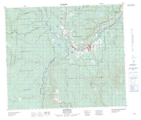
093L07 Houston Canada topo map, 1:50,000 scale
093L07 Houston NRCAN topographic map.
Includes UTM and GPS geographic coordinates (latitude and longitude). This 50k scale map is suitable for hiking, camping, and exploring, or you could frame it as a wall map.
Printed on-demand using high resolution, on heavy weight and acid free paper, or as an upgrade on a variety of synthetic materials.
Topos available on paper, Waterproof, Poly, or Tyvek. Usually shipping rolled, unless combined with other folded maps in one order.
- Product Number: NRCAN-093L07
- Parent Topo: TOPO-093L
- Map ID also known as: 093L07, 93L7, 93L07
- Unfolded Size: Approximately 26" high by 36" wide
- Weight (paper map): ca. 55 grams
- Map Type: POD NRCAN Topographic Map
- Map Scale: 1:50,000
- Geographical region: British Columbia, Canada
Neighboring Maps:
All neighboring Canadian topo maps are available for sale online at 1:50,000 scale.
Purchase the smaller scale map covering this area: Topo-093L
Spatial coverage:
Topo map sheet 093L07 Houston covers the following places:
- Houston - Barrett Lake - Dunalter Lake - Helen Lake - Klinger Lake - Mathews Lake - McKilligan Lake - Silverthorne Lake - Summit Lake - Vallee Lake - Wilson Lake - Bulkley Ranges - Hazelton Mountains - Mount Harry Davis - Mount Morice - Telkwa Range - Regional District of Bulkley-Nechako - Interior Plateau - Nechako Plateau - Aitken Creek - Barren Creek - Bob Creek - Buck Creek - Bulkley River - Dockrill Creek - Dunalter Creek - Dungate Creek - Emerson Creek - Henry Creek - Houston Tommy Creek - Knapper Creek - Mathews Creek - McInnes Creek - McKilligan Creek - Morice River - Peacock Creek - Raspberry Creek - Silverthorne Creek - Stock Creek - Teer Creek - Vallee Creek - West McInnes Creek - Barrett - Barrett Lake - Derek - Knockholt - Lucas - Buck Flat


