
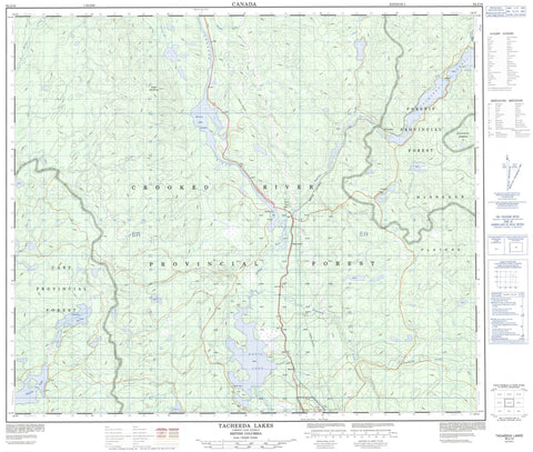
093J10 Tacheeda Lakes Canada topo map, 1:50,000 scale
093J10 Tacheeda Lakes NRCAN topographic map.
Includes UTM and GPS geographic coordinates (latitude and longitude). This 50k scale map is suitable for hiking, camping, and exploring, or you could frame it as a wall map.
Printed on-demand using high resolution, on heavy weight and acid free paper, or as an upgrade on a variety of synthetic materials.
Topos available on paper, Waterproof, Poly, or Tyvek. Usually shipping rolled, unless combined with other folded maps in one order.
- Product Number: NRCAN-093J10
- Parent Topo: TOPO-093J
- Map ID also known as: 093J10, 93J10
- Unfolded Size: Approximately 26" high by 36" wide
- Weight (paper map): ca. 55 grams
- Map Type: POD NRCAN Topographic Map
- Map Scale: 1:50,000
- Geographical region: British Columbia, Canada
Neighboring Maps:
All neighboring Canadian topo maps are available for sale online at 1:50,000 scale.
Purchase the smaller scale map covering this area: Topo-093J
Spatial coverage:
Topo map sheet 093J10 Tacheeda Lakes covers the following places:
- Davie Lake 28 - Kerry Lake East 9 - Kerry Lake West 8 - Tacheeda Lake 14 - Davie Lake - Easter Lakes - Fisher Lake - Fishhook Lake - Hambone Lake - Hidden Lake - Horseshoe Lake - Kerry Lake - Lincoln Lake - Lookout Lake - Merton Lake - Paradise Lake - Peculiar Lake - Polar Mill Pond - Redrocky Lake - Snag Lake - Tacheeda Lakes - Toodick Lake - Kerry Mountain - Regional District of Fraser-Fort George - Interior Plateau - McGregor Plateau - Nechako Plateau - Altezega Creek - Angusmac Creek - Chuchinka Creek - Copper Creek - Crooked River - Lincoln Creek - Redrocky Creek - Tacheeda Creek - Weedon Creek - Angusmac - Bear Lake - Davie - Killy - Tacheeda - Rocky Mountain Trench


