
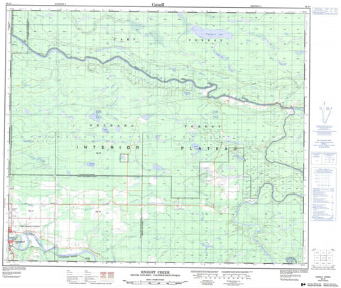
093J04 Knight Creek Canada topo map, 1:50,000 scale
093J04 Knight Creek NRCAN topographic map.
Includes UTM and GPS geographic coordinates (latitude and longitude). This 50k scale map is suitable for hiking, camping, and exploring, or you could frame it as a wall map.
Printed on-demand using high resolution, on heavy weight and acid free paper, or as an upgrade on a variety of synthetic materials.
Topos available on paper, Waterproof, Poly, or Tyvek. Usually shipping rolled, unless combined with other folded maps in one order.
- Product Number: NRCAN-093J04
- Parent Topo: TOPO-093J
- Map ID also known as: 093J04, 93J4, 93J04
- Unfolded Size: Approximately 26" high by 36" wide
- Weight (paper map): ca. 55 grams
- Map Type: POD NRCAN Topographic Map
- Map Scale: 1:50,000
- Geographical region: British Columbia, Canada
Neighboring Maps:
All neighboring Canadian topo maps are available for sale online at 1:50,000 scale.
Purchase the smaller scale map covering this area: Topo-093J
Spatial coverage:
Topo map sheet 093J04 Knight Creek covers the following places:
- Vanderhoof - Breadalbane Lake - Davidson Lake - Franklin Lake - Janzé Lake - Margaret Lake - Millard Lake - Puttah Lake - Second Lake - Shanley Lake - St. Mary Lake - Waterlily Lake - Webber Lake - Windfall Lake - Regional District of Bulkley-Nechako - Regional District of Fraser-Fort George - Nechako River Bird Sanctuary - Refuge d'oiseaux de la rivière Nechako - Stuart River Park - Interior Plateau - Nechako Plateau - Breadalbane Creek - Burnstead Creek - Chinohchey Creek - Gilbert Creek - Gravel Creek - Janzé Creek - Knight Creek - Leduc Creek - Leona Creek - Mandalay Creek - Martens Creek - Millard Creek - Nechako River - Necoslie River - Neuco Creek - Puttah Creek - Shillestead Brook - Stoney Creek - Stuart River - Tritt Creek - Webber Creek - Cariboo - Chilco - Ellesby - Sinkut - Bernies Bog - Leduc Marsh


