
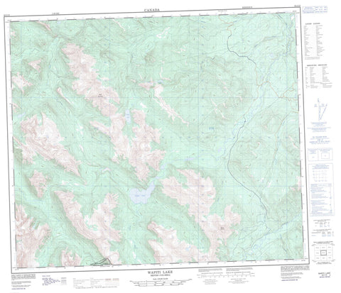
093I10 Wapiti Lake Canada topo map, 1:50,000 scale
093I10 Wapiti Lake NRCAN topographic map.
Includes UTM and GPS geographic coordinates (latitude and longitude). This 50k scale map is suitable for hiking, camping, and exploring, or you could frame it as a wall map.
Printed on-demand using high resolution, on heavy weight and acid free paper, or as an upgrade on a variety of synthetic materials.
Topos available on paper, Waterproof, Poly, or Tyvek. Usually shipping rolled, unless combined with other folded maps in one order.
- Product Number: NRCAN-093I10
- Parent Topo: TOPO-093I
- Map ID also known as: 093I10, 93I10
- Unfolded Size: Approximately 26" high by 36" wide
- Weight (paper map): ca. 55 grams
- Map Type: POD NRCAN Topographic Map
- Map Scale: 1:50,000
- Geographical region: British Columbia, Canada
Neighboring Maps:
All neighboring Canadian topo maps are available for sale online at 1:50,000 scale.
Purchase the smaller scale map covering this area: Topo-093I
Spatial coverage:
Topo map sheet 093I10 Wapiti Lake covers the following places:
- Wapiti Falls - Barber Lake - Duke Lake - Fellers Lake - Fossil Fish Lake - Johnson Lake - Lost Moraine Lake - Onion Lake - Wapiti Lake - Bertram Peak - Bone Mountain - Francis Peak - Montagnes Rocheuses - Mount Anderson - Mount Becker - Rocky Mountain Foothills - Rocky Mountains - Wapitik Mountain - Warn Peak - Peace River Regional District - Monkman Park - Wapiti Lake Park - Becker Creek - Bulley Creek - Dokken Creek - Fearless Creek - Fellers Creek - Little Prairie Creek - Mitska Creek - Onion Creek - Red Deer Creek - Wapiti River - Whatley Creek


