
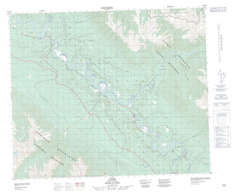
093H10 Loos Canada topo map, 1:50,000 scale
093H10 Loos NRCAN topographic map.
Includes UTM and GPS geographic coordinates (latitude and longitude). This 50k scale map is suitable for hiking, camping, and exploring, or you could frame it as a wall map.
Printed on-demand using high resolution, on heavy weight and acid free paper, or as an upgrade on a variety of synthetic materials.
Topos available on paper, Waterproof, Poly, or Tyvek. Usually shipping rolled, unless combined with other folded maps in one order.
- Product Number: NRCAN-093H10
- Parent Topo: TOPO-093H
- Map ID also known as: 093H10, 93H10
- Unfolded Size: Approximately 26" high by 36" wide
- Weight (paper map): ca. 55 grams
- Map Type: POD NRCAN Topographic Map
- Map Scale: 1:50,000
- Geographical region: British Columbia, Canada
Neighboring Maps:
All neighboring Canadian topo maps are available for sale online at 1:50,000 scale.
Purchase the smaller scale map covering this area: Topo-093H
Spatial coverage:
Topo map sheet 093H10 Loos covers the following places:
- Goose Island - La Salle Lakes - Oog Lake - Cariboo Mountains - Columbia Mountains - Montagnes Rocheuses - Oog Mountain - Park Ranges - Rocky Mountains - Zig Zag Ridge - Regional District of Fraser-Fort George - Erg Mountain Park - Goat River Rapids - Catfish Creek - Crooked Creek - Fraser River - Fyfe Creek - Goat River - Hellroaring Creek - Humbug Creek - La Salle Creek - Laselle Creek - Mackenzie Creek - Morkill River - Oog Creek - P.O.B. Creek - Ptarmigan Creek - Shiko Creek - Snowshoe Creek - Torpy River - Walker Creek - The Big Eddy - Crescent Spur - Goat River - Kidd - Loos - Urling - Robson Valley - Rocky Mountain Trench


