
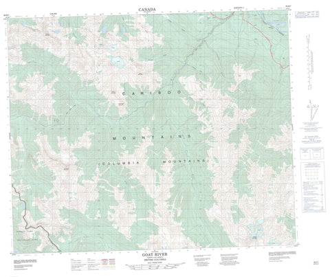
093H07 Goat River Canada topo map, 1:50,000 scale
093H07 Goat River NRCAN topographic map.
Includes UTM and GPS geographic coordinates (latitude and longitude). This 50k scale map is suitable for hiking, camping, and exploring, or you could frame it as a wall map.
Printed on-demand using high resolution, on heavy weight and acid free paper, or as an upgrade on a variety of synthetic materials.
Topos available on paper, Waterproof, Poly, or Tyvek. Usually shipping rolled, unless combined with other folded maps in one order.
- Product Number: NRCAN-093H07
- Parent Topo: TOPO-093H
- Map ID also known as: 093H07, 93H7, 93H07
- Unfolded Size: Approximately 26" high by 36" wide
- Weight (paper map): ca. 55 grams
- Map Type: POD NRCAN Topographic Map
- Map Scale: 1:50,000
- Geographical region: British Columbia, Canada
Neighboring Maps:
All neighboring Canadian topo maps are available for sale online at 1:50,000 scale.
Purchase the smaller scale map covering this area: Topo-093H
Spatial coverage:
Topo map sheet 093H07 Goat River covers the following places:
- Diggens Lake - Isaac Lake - Cariboo Mountains - Columbia Mountains - Goat Mountain - Macleod Mountain - Mount Halvorson - Mount Hammel - Mount Macleod - North Star Mountain - Whitehorse Mountain - Zig Zag Mountains - Zig Zag Range - Zig Zag Ridge - Cariboo Regional District - Regional District of Fraser-Fort George - Bowron Lake Park - Ptarmigan Park - West Twin Park - Betty Wendle Creek - Boreal Creek - Bounding Creek - Diggings Creek - Fraser River - Goat River - Kendall Creek - Killam Creek - La Salle Creek - Macleod Creek - Milk River - Moxley Creek - North Star Creek - Ozalenka Creek - Ptarmigan Creek - Quartz Creek - Snowshoe Creek - Summit Creek - Top Creek - West Twin Creek - Whitehorse Creek - Rider - Robson Valley - Rocky Mountain Trench


