
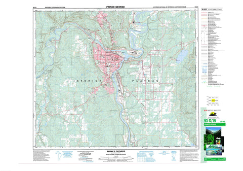
093G15 Prince George Canada topo map, 1:50,000 scale
093G15 Prince George NRCAN topographic map.
Includes UTM and GPS geographic coordinates (latitude and longitude). This 50k scale map is suitable for hiking, camping, and exploring, or you could frame it as a wall map.
Printed on-demand using high resolution, on heavy weight and acid free paper, or as an upgrade on a variety of synthetic materials.
Topos available on paper, Waterproof, Poly, or Tyvek. Usually shipping rolled, unless combined with other folded maps in one order.
- Product Number: NRCAN-093G15
- Parent Topo: TOPO-093G
- Map ID also known as: 093G15, 93G15
- Unfolded Size: Approximately 26" high by 36" wide
- Weight (paper map): ca. 55 grams
- Map Type: POD NRCAN Topographic Map
- Map Scale: 1:50,000
- Geographical region: British Columbia, Canada
Neighboring Maps:
All neighboring Canadian topo maps are available for sale online at 1:50,000 scale.
Purchase the smaller scale map covering this area: Topo-093G
Spatial coverage:
Topo map sheet 093G15 Prince George covers the following places:
- Prince George - Clesbaoneecheck Indian Reserve 3 - Fort George Cemetery Indian Reserve 1A - Réserve indienne Clesbaoneecheck 3 - Réserve indienne Fort George Cemetery 1A - Réserve indienne Salaquo (Chilako River) 4 - Salaquo (Chilako River) Indian Reserve 4 - Cottonwood Island - Goat Island - Aird Lake - Bobs Pond - Buckhorn Lake - Haggith Lake - Hudsons Bay Slough - Shane Lake - Tabor Lake - Carney Hill - Connaught Hill - Cranbrook Hill - Regional District of Fraser-Fort George - McMillan Creek Park - Interior Plateau - Aird Creek - Beaverley Creek - Bertschi Creek - Bittner Creek - Brodman Creek - Cale Creek - Chilako River - Corless Creek - Dodd Creek - Dougherty Creek - Eenastick Creek - Ellacott Creek - Fleuve Fraser - Fraser River - Fyfe Creek - Garvin Creek - Haggith Creek - McMillan Creek - Nechako River - Ohr Creek - Parkridge Creek - Porter Creek - Shane Creek - Skaret Creek - Starbaby Creek - Swede Creek - Tabor Creek - Tabor Mountain Creek - Vienna Creek - Zogas Creek - Basford - Beaverley - Bonnet Hill - Bridge - Buckhorn - Carlson - Charella Garden - Chilako - College Heights - Foreman - Fraserview - Hart Highlands - Huble - Island Cache - Miller - Miworth - Nichols - North Nechako - Otway - Pineview - Shady Valley - Shelley - Somerville - South Fort George - Tabor - Vanway


