
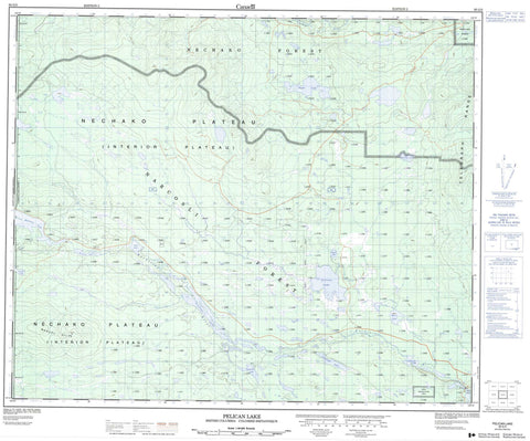
093G05 Pelican Lake Canada topo map, 1:50,000 scale
093G05 Pelican Lake NRCAN topographic map.
Includes UTM and GPS geographic coordinates (latitude and longitude). This 50k scale map is suitable for hiking, camping, and exploring, or you could frame it as a wall map.
Printed on-demand using high resolution, on heavy weight and acid free paper, or as an upgrade on a variety of synthetic materials.
Topos available on paper, Waterproof, Poly, or Tyvek. Usually shipping rolled, unless combined with other folded maps in one order.
- Product Number: NRCAN-093G05
- Parent Topo: TOPO-093G
- Map ID also known as: 093G05, 93G5, 93G05
- Unfolded Size: Approximately 26" high by 36" wide
- Weight (paper map): ca. 55 grams
- Map Type: POD NRCAN Topographic Map
- Map Scale: 1:50,000
- Geographical region: British Columbia, Canada
Neighboring Maps:
All neighboring Canadian topo maps are available for sale online at 1:50,000 scale.
Purchase the smaller scale map covering this area: Topo-093G
Spatial coverage:
Topo map sheet 093G05 Pelican Lake covers the following places:
- Euchinico Creek Indian Reserve 19 - Réserve indienne Euchinico Creek 19 - Batnuni Lake - Boat Lake - Chuniar Lake - Cotsworth Lake - Gesul Buhn - Hanham Lake - Holman Lake - Meadow Lake - Moses Lake - Nuntzun Lake - Pelican Lake - Purdy Lake - Sheein Lake - Sheerin Lake - Tagai Lake - Titetown Lake - Tucker Lake - Yimpakluk Lake - Marcel Hills - Telegraph Range - Cariboo Regional District - Interior Plateau - Nechako Plateau - Boat Lake Creek - Chilako River - Euchiniko River - Gesul Buhn Creek - Nataniko Creek - Swede Creek - West Road (Blackwater) River


