
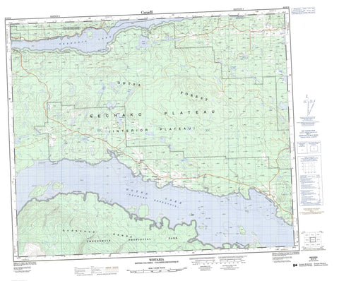
093E16 Wistaria Canada topo map, 1:50,000 scale
093E16 Wistaria NRCAN topographic map.
Includes UTM and GPS geographic coordinates (latitude and longitude). This 50k scale map is suitable for hiking, camping, and exploring, or you could frame it as a wall map.
Printed on-demand using high resolution, on heavy weight and acid free paper, or as an upgrade on a variety of synthetic materials.
Topos available on paper, Waterproof, Poly, or Tyvek. Usually shipping rolled, unless combined with other folded maps in one order.
- Product Number: NRCAN-093E16
- Parent Topo: TOPO-093E
- Map ID also known as: 093E16, 93E16
- Unfolded Size: Approximately 26" high by 36" wide
- Weight (paper map): ca. 55 grams
- Map Type: POD NRCAN Topographic Map
- Map Scale: 1:50,000
- Geographical region: British Columbia, Canada
Neighboring Maps:
All neighboring Canadian topo maps are available for sale online at 1:50,000 scale.
Purchase the smaller scale map covering this area: Topo-093E
Spatial coverage:
Topo map sheet 093E16 Wistaria covers the following places:
- Streatham Bay - Windy Point - Isaac (Gale Lake) Indian Reserve 8 - Réserve indienne Isaac (Gale Lake) 8 - Réserve indienne Tatla 1 - Réserve indienne Tatla 1 - Réserve indienne Tatla West 11 - Réserve indienne Tatla't East 2 - Tatla Indian Reserve 1 - Tatla Indian Reserve 1 - Tatla West Indian Reserve 11 - Tatla't East Indian Reserve 2 - Barker Island - Knox Island - Paradise Island - Boden Lake - Carroll Lake - Eastern Lake - Enter Lake - François Lake - Gale Lake - Isaac Lake - Jesson Lake - Katharine Lake - Little Boden Lake - Lund Lake - Murdoch Lake - Nechako Reservoir - Oknianski Lake - Ootsa Lake - Richardson Lake - Sedge Lake - Snake Lake - Tatalrose Lake - Wasp Lake - Regional District of Bulkley-Nechako - Tweedsmuir Park - Wistaria Park - Interior Plateau - Nechako Plateau - Arethusa Creek - Eastern Creek - Goodwin Creek - MacIvor Creek - McDonald Creek - Shelford Creek - Van Lear Creek - Wells Creek - Wynkes Creek - Noralee - Ootsa - Ootsa Lake - Streatham - Wistaria - Wistaria


